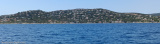
Port well sheltered from Mistral and Ponant. Beware: a flat marked by a green pole 100 m to starboard when entering the harbour to be given a wide berth when arriving from the N.
130 B. inc. 8 visit (<10m)
2012/03/25
Update
DD
Profond d'une centaine de mètres, ce port presque naturel n'offre un abri convenable que par Mistral et Ponant de SW. La houle, par vent d'E, passe par dessus les enrochements de la digue et rend la passe très délicate du fait du ressac. Attention, dans la passe, aux roches (signalées par une perche verte) qui affleurent sur tribord.
130 pl. dont 8 visit. (<10m)
T/F: 04 94 49 51 56
Mouillage possible au S de l'entrée du port,sur fond de sable, sauf par vent d'E.
Prohibited areas, the limits of which are shown on the chart, lie SW of Pointe du Titan (Ile du Levant) and extend up to 2 miles from the coast. These areas, which are used by French naval vessels, are not in force between July 1 and August 31. Vessels are prohibited from approaching ...
Access: green and red conical buoys (1/5 to 1/12). Narrow chanel, keep in the center of the channel. Access difficult in E winds, not recommended at night. 20 B. inc. 2 visit. (<13m) Depth: basin 1,70m
Mouillage avec fond de sable par 5 à 7 mètres de fond.Site assez sympathique malgré la proximité de la route repérable par la forme ronde caractéristique du restaurant sur la droite de la calanque en arrivant devantA éviter par vent d'Est
Port sheltered from Mistral wind and E wind swell. Danger: Sandbanks in the port passage when entering, marked by a conical yellow buoy, draught minimum 2 m. 239 B. (<15mx4,50m) inc. 2 visit. (1 of 10mx3,40m and 1 of 5,50mx2,15m)
This bay is bordered by numerous villas, and a large white building, which is very prominent from seaward, stands on its N shore. The bay offers shelter from NW winds, but the anchorage is untenable with winds from seaward. Vessels may anchor to seek shelter from the Mistral, ...


 canal 9


1.jpg "Port Ferréol (Les Issambres)")
.jpg "Port Ferréol (Les Issambres)")
 Port well sheltered from Mistral and Ponant.
 Profond d'une centaine de mètres, ce port presque naturel n'offre un abri convenable que par Mistral et Ponant de SW. La houle, par vent d'E, passe par dessus les enrochements de la digue et rend la passe très délicate du fait du ressac.