

Sønderborg - DK
0.6nm
338°
26 Jul 11
JB Antibes
| Latitude | Longitude | |
| DMS | --- | --- |
| DM | --- | --- |
| DD | --- | --- |

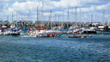
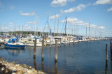
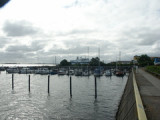
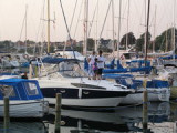
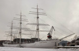
Sønderborg Lystbådehavn
Sønderborg Lystbådehavn is music is making close the Skov and directly the Sandstrand , where the blå flag vajer . There is 15 min . bande to bycentrum . There is based læmole mod NV . Also is servicebygningen been enlarged with fordobling of bød and toiletfaciliteter , handicaptoilet , Establishment of vaskeri , puslerum , Køge - and opvaskerum , as well as aftømningsmulighed for tørklosetter . De can also use Dem of indkøbsmulighederne the Havnen : Brændstof - Proviant and bådudstyr . There is grillplads , as well as legeplads to børnene on havneområdet . Vi foretager not reservering of pladser
By: Holger Novotny Thomsen
Ebook | Baltic sea
|