Sønderborg Lystbådehavn - DK

Sønderborg Lystbådehavn - DK

Pour géolocaliser ce lieu. Mettre à jour si besoin.

Localisation

Sønderborg Lystbådehavn - DK
LatitudeLongitude
DMS------
DM------
DD------

Caractéristiques

Port

Description

Sønderborg Lystbådehavn


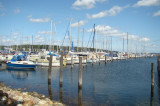
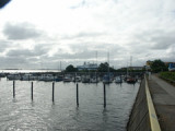
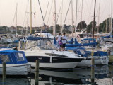
Sønderborg Lystbådehavn is music is making close the Skov and directly the Sandstrand , where the blå flag vajer . There is 15 min . bande to bycentrum . There is based læmole mod NV . Also is servicebygningen been enlarged with fordobling of bød and toiletfaciliteter , handicaptoilet , Establishment of vaskeri , puslerum , Køge - and opvaskerum , as well as aftømningsmulighed for tørklosetter . De can also use Dem of indkøbsmulighederne the Havnen : Brændstof - Proviant and bådudstyr . There is grillplads , as well as legeplads to børnene on havneområdet . Vi foretager not reservering of pladser

By: Holger Novotny Thomsen

2010/10/26
Mettre à jour
Ebook

Baltic sea

  • 84 sites
  • 71 photos
  • publication date: 11 Jul 2023
  • .pdf file size: 70 Mb
Partagez vos remarques ou photos sur "Sønderborg Lystbådehavn - DK"

Sites autour de Sønderborg Lystbådehavn - DK

Flying distances - Direct line

Kegnæs - DK

7.2nm
112°
Kegnæs LighthouseAlsThe first lighthouse erected on Kegnæs, was built in 1844-45. In 1864 the lighthouse was transferred to the German administration in conjunction with other lighthouse in Schleswig-Holstein. In 1896 entered the German administration the current 18 meter ...
15 Dec 09
holger

Assens Marina

22nm
Port protégé par une digue.
4 Aug 11
printtint

Abenra Marina

15nm
303°
Port protégé par une digue.
4 Aug 11
Giovanni74

Aeroskobing

21nm
90°
Petit port protégé par une digue.
4 Aug 11
alecarretti