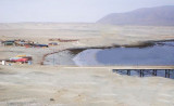
The Punta Lagartos is in front of a bank (banco Lagartos) that lies at 0,5 NM from it. Islote Lagartos is at about the center of the bank. the islet is 4,9 to 5,8 m high. It is rock covered with white shells and can be recognized for 3 NM.
Rocks extend some distance NW and S from the islet. A reef extends nearly 0.5 mile NNW from the islet and terminates in an above-water rock. The boilers of a wrecked steamer lie on this reef and are always visible.
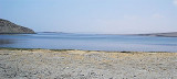
It is a spot of windsurf.
2012/12/22
Update
Joëlle
2012-12-22
Update
Joëlle
La Punta Lagartos se trouve face à un banc (banco Lagartos) qui s'étend à 0,5 MN de celui-ci. Islote Lagartos se trouve à peu près au centre du banc. Celui-ci est haut de 4,9 à 5,8 m. Il est rocheux et couvert de coquillages blancs. On peut l'apercevoir dès 3 MN.
Des rochers s'étendent au NW et au S de l'îlot. Un rocher se trouve à environ 0,5 MN au NNW de l'îlot et se termine par un rocher émergé. Les chaudières d'un paquebot naufragé se trouvent sur ces récifs et sont toujours visibles.
Santa Maria island is between caleta Constitucion and caleta Errazuriz. Reefs extend a little over 0.5 mile SSW from the S side of the island and up to 0.3 mile from all other sides.
Caleta Constitucion is entered NE of isla Santa Maria. The entrance between the reefs, which extend N from the island and those which extend about 0.3 NM S from the N entrance point, is about 0.5 NM wide and has a least depth of 13.7m. A channel, about 180 m wide at its narrowest ...
Caleta Errazuriz is S Santa Maria island. The channel between the reefs, which extend SSW from the island and those with extend about 0,3 NM N from the W entrance point of the cove, is about 0,3 NM wide and has depths over 27,4 m.
Punta Tetas is the SW extremity of Peninsula Moreno. The point is of moderate height, rocky,and arid. Punta Tetas is free of off-lying dangers and a light is shown from it.


 The Punta Lagartos is in front of a bank (banco Lagartos) that lies at 0,5 NM from it.
")
 La Punta Lagartos se trouve face à un banc (banco Lagartos) qui s'étend à 0,5 MN de celui-ci.
") islote Lagartos.
islote Lagartos.") windsurfing
windsurfing