Caleta Constitucion (Antofagasta N Chile)

Caleta Constitucion (Antofagasta N Chile)

To precisely geolocate this site. Update if necessary.

Localisation

Caleta Constitucion (Antofagasta N Chile)
LatitudeLongitude
DMS------
DM------
DD------

Characteristics

Mud
Mooring
Beach
Sand
Windsurf

Description

Caleta Constitucion is entered NE of isla Santa Maria.
The entrance between the reefs, which extend N from the island and those which extend about 0.3 NM S from the N entrance point, is about 0.5 NM wide and has a least depth of 13.7m. 

A channel, about 180 m wide at its narrowest part and with a depth of 11.9 m, trends S between Isla Santa Maria and the mainland and connects Caleta Constitucion and Caleta Errazuriz.

We can anchor in the cove, NE of Isla Santa Maria and the mainland. The best anchorage is at about 0,5 NM ENE of the N end of the island, in 11 to 18.3m.

Beware, the land breeze, called "paracas", is sometimes strong, especially at night.

2012/12/22
Update
Joëlle
Caleta Constitucion (Antofagasta N Chile)
Caleta Constitucion
2012-12-22
Update
Joëlle
Caleta Constitucion se trouve au NE de l'île Santa Maria. 
L'entrée entre les rochers, qui s'étendent au N de l'île et ceux qui s'étendent à environ 0,3 MN au S de l'entrée N, est large d'environ 0,5 MN et a une profondeur de 13,7 m.

Un chenal, d'environ 180 m de large dans sa partie la plus étroite, avec une profondeur de 11,9 m, se trouve au S entre l'île Santa Maria et le continent et relie cala Constitucion à Caleta Errazuriz.

On peut ancrer dans l'anse, au NE de Isla Santa Maria et le continent. Le meilleur mouillage se trouve à environ 0,5 MN à l'ENE de l'extrémité N de l'île, par 11 à 18,3 m.

Attention la brise de terre, appelée "paracas", est quelquefois forte, notamment la nuit.

2012/12/22
Update
Joëlle
Caleta Constitucion (Antofagasta N Chile)
Caleta Constitucion
2012-12-22
Update
Joëlle
Caleta Constitucion (Antofagasta N Chile)
2012-12-22
Update
Joëlle
Ebook

Chile

  • 118 sites
  • 166 photos
  • publication date: 6 Jul 2023
  • .pdf file size: 34 Mb
Share your comments or photos on "Caleta Constitucion (Antofagasta N Chile)"

Sites around Caleta Constitucion (Antofagasta N Chile)

Flying distances - Direct line

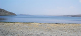
Isla Santa Maria (Antofagasta N Chile)

0.9nm
216°
Santa Maria island is between caleta Constitucion and caleta Errazuriz.
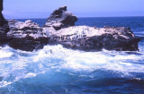
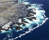
Reefs extend a little over 0.5 mile SSW from the S side of the island and up to 0.3 mile from all other sides.
22 Dec 12
Joëlle

Caleta Errazuriz (Antofagasta N Chile)

2.2nm
190°
Caleta Errazuriz is S Santa Maria island.
The channel between the reefs, which extend SSW from the island and those with extend about 0,3 NM N from the W entrance point of the cove, is about 0,3 NM wide and has depths over 27,4 m.
22 Dec 12
Joëlle

Punta Lagartos (Antofagasta N Chile)

3.7nm
352°
The Punta Lagartos is in front of a bank (banco Lagartos) that lies at 0,5 NM from it.
Islote Lagartos is at about the center of the bank. the islet is 4,9 to 5,8 m high. It is rock covered with white shells and can be recognized for 3 NM.Rocks extend some distance NW and S from ...
22 Dec 12
Joëlle

Punta Tetas (Antofagasta N Chile)

5.5nm
195°
Punta Tetas is the SW extremity of Peninsula Moreno. The point is of moderate height, rocky,and arid.
Punta Tetas is free of off-lying dangers and a light is shown from it.
23 Dec 12
Joëlle

Caleta Abtao (Antofagasta N Chile)

6.2nm
140°
Caleta Abtao is W Moreno bay.
The cove is well-sheltered and has little or no swell.We can anchor at about 0,3 NM of the S entrance, in 17 m.
23 Dec 12
Joëlle