Prolaz Zapuntel (Molat)

Prolaz Zapuntel (Molat)

To precisely geolocate this site. Update if necessary.

Localisation

Characteristics

Port
Mud
Mooring buoy
Mooring Bonne tenue
Sand
Phone au hameau
Restaurant

Description

Prolaz Zapuntel (Molat)
2008-07-23
Update
Prolaz Zapuntel (Molat)
2008-07-23
Update
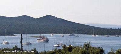
Prolaz Zapuntel is the channel between the islands of Molat and Ist.
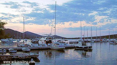
Moorings on the banks N and S of the channel provide excellent protection and complete in a beautiful setting.
The approach by the coast E of Molat or Ist is straightforward. The approach by the W side demands attention (many islands, shoals and rocks). The input E is deep but there are only 5.80 m deep in the lobby W. Here you can meet strong currents of up to 3 knots.
It is forbidden to anchor in the channel axis and in the W input is crossed by a submarine cable. The moorings are equipped with buoys for visitors in the Bay and Bay NW S to the hamlet. A right anchor and a tax is charged for visitors at night.
You can anchor in 4, 8 m in the NW or SW of the basin of the bay near the pier, by 8 m. Bottom of sand or mud of good behavior.
The Bora is blowing strongly in the middle of the basin, but the mooring N and S provide complete protection, even in Bora.
2011/07/24
Update
Jojo
Ebook

Zadarska županija (Zadar county)

  • 95 sites
  • 136 photos
  • publication date: 6 Aug 2024
  • .pdf file size: 52 Mb
Prolaz Zapuntel est le chenal entre les îles de Molat et de Ist.
Les mouillages sur les rives N et au S du chenal offrent une excellente et totale protection dans un cadre magnifique.

L'approche par les côtes E de Molat ou de Ist est franche. L'approche par la côte W demande de l'attention (nombreux îlots, hauts-fonds et roches). L'entrée E est profonde mais il y a seulement 5,80 m de fond dans l'entrée W. On peut rencontrer ici de forts courants pouvant atteindre 3 nœuds.

Il est interdit de mouiller dans l'axe du chenal ainsi que dans l'entrée W qui est traversée par un câble sous-marin. Les mouillages sont aménagés avec des bouées pour les visiteurs dans la baie NW et dans la baie S devant le hameau. Un droit de mouillage et une taxe visiteur sont perçus pour la nuit.

On peut mouiller par 4, 8 m dans le NW du bassin ou au S de la baie, près du môle, par 8 m. Fond de sable ou de vase de bonne tenue.
La Bora souffle avec force au milieu du bassin, mais les mouillages au N et au S procurent une protection totale, même par Bora.
2011/07/24
Update
Jojo
Share your comments or photos on "Prolaz Zapuntel (Molat)"

Sites around Prolaz Zapuntel (Molat)

Flying distances - Direct line

Otok Olib Zadar

7.4nm
353°
Otok Olib is located E of O. Silba. It belongs to Zadar archipelago.The island has been inhabited since Roman times. The residents bought their island in 1900. The only village on the island was established around the port.
To the east of the island you will find some small hidden ...
27 Jul 11
Jojo

Olipski Kanal

8.1nm
341°
Olipski Kanal leads NNW between the E side of Otok Silba and the W side of Otok Olib and merges into the N end of Pohlipski Kanal.
This channel is deep and has a minimum navigable width of 0.7 mile. It is often used by vessels proceeding to and from Zadar.
Good anchorage is ...
18 Sep 11
Jojo

Kanal Nove Povljane Vir

13nm
74°
Kanal Nove Povljane, entered between Otok Vir and the SE end of Otok Pag, leads 5 miles SE into Ninski Zaliv.
Shoals at the inner end of this channel restrict the fairway to a width of about 250m, with a controlling depth of 8m. Vessels with a draft of over 6m are advised not to ...
23 Jul 11
Jojo

Rivanjski Kanal

10nm
123°
Rivanjski Kanal continues NW from the N end of Srednji Kanal and leads between Otok Rivanj andOtok Sestrunj.
It is generally used by vessels proceeding between Srednji and Zadarski Kanals.
Otocic Tri Sestrice, a group of islets and rocks, extend up to 2 miles NW of Rt Zanavin, ...
9 Sep 11
Jojo

Otok Premuda Zadar

8.7nm
299°
Premuda is located northwest of Otok Skarda which it is separated by a channel about 0.9 m wide (Premuda Vrata). The tips of each side of the channel are overwhelmed shoals and should not be approached too closely.
The coast is home to 2 W moorings and a small port and there is ...
17 Sep 11
Jojo

Otok Ist Zadar

1.5nm
283°
The island, part of the archipelago of Zadar, is located northwest of Otok Molat which it is separated by the channel prolaz Zapuntel (narrow channel with a minimum depth of 6 m).
Otok Ist to the shape of a butterfly with two bays that enter the island on the coast NW and SE.
Ist ...
26 Jul 11
Jojo