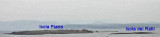
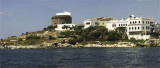
Piana island is part of archipelago del Sulcis. It is located NE tip of San Pietro (located on the island of the same name).On the island is the "Residence Villamarina" residential area which covers the entire island. The island is private and to access you must go to the office ...
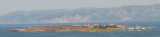
La Punta is the NE end of S. Pietro island. The N end of the island is rocky, low and flat on wich we see a tunny fishery. Even today you can see a "matanza" the old style. You can ask permission to the factory to see the show.NE of Punta is Piana island and dei Ratti ...
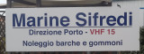
Marina Sifredi, SW Sardinia, is on the E side of Isola di San Pietro, close to the only town on the island, Caloforte. Marina Sifredi has two marinas located respectively in the North and South of Caloforte harbour. Sifredi marina is in the N and S area of Caloforte harbour. Mamma ...
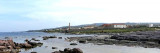
Scoglio La Ghinghetta lies 1 NM of Portoscuso entrance and is surrounded by rocks. A light is shown from a tower, 10 m high, standing on this rocky shoal.Several shoal patches, with depth of 3 to 7 m lie about 1,6 NM WNW of the light and are marked by a lighted buoy.
Portoscuso tower lies on a hill overlooking the small maritime town, including the small Ghinghetta cove and the cliff of Port Paleddu. Strategic location from wich you can maintain eye contact with the other coastal towers (Calasetta and Carloforte).


 canal 72, 9


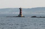
 The islet is private. On the SE coast is a small private port (Villamaria) with a small beakwater.
 L'île est un lieu de vacances privé. La côte SE abrite un petit port ( Villamarina) protégé par un court brise-lames.
  L'isolatto è privata. Sulla costa SE è un porticiolo (Villamaria) con una piccola diga frangiflutti.
")
")
")