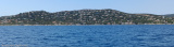
Port sheltered from Mistral wind and E wind swell. Danger: Sandbanks in the port passage when entering, marked by a conical yellow buoy, draught minimum 2 m.
239 B. (<15mx4,50m) inc. 2 visit. (1 of 10mx3,40m and 1 of 5,50mx2,15m)
2012/03/25
Update
DD
2015:07:21 13:34:27
2015-08-09
Update
Atb
L'ancien petit abri en haut de la longue plage de sable de St Aygulf a été transformé en un véritable port par l'allongement de l'ancienne digue et la construction d'une contre jetée qui délimite un bassin assez bien abrité du Mistral et de la houle par vent d'E. Danger: banc de sable à la passe du port côté tribord en entrant, signalé par bouée jaune et conique, tirant d'eau <2m.
T. + 33 (0)4.94.52.74.52
Fax : + 33 (0)4.94.52.74.56
239 pl. (<15mx4,50) dont 2 visit. (1 de 10mx3,40m et 1 de 5,50mx2,15m)
Prohibited areas, the limits of which are shown on the chart, lie SW of Pointe du Titan (Ile du Levant) and extend up to 2 miles from the coast. These areas, which are used by French naval vessels, are not in force between July 1 and August 31. Vessels are prohibited from approaching ...
Port well sheltered from Mistral and Ponant. Beware: a flat marked by a green pole 100 m to starboard when entering the harbour to be given a wide berth when arriving from the N. 130 B. inc. 8 visit (<10m)
Access: green and red conical buoys (1/5 to 1/12). Narrow chanel, keep in the center of the channel. Access difficult in E winds, not recommended at night. 20 B. inc. 2 visit. (<13m) Depth: basin 1,70m
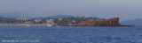
Mouillage avec fond de sable par 5 à 7 mètres de fond.Site assez sympathique malgré la proximité de la route repérable par la forme ronde caractéristique du restaurant sur la droite de la calanque en arrivant devantA éviter par vent d'Est
Lieu de plongée très connu. De très nombreuses plongées sont effectuées
autour de cet îlot rocheux. S'amarrer à la bouée le plus au sud pour
faire le tombant au sud du rocher. Faire le tour du tout petit rocher
sud et vous aurez fini la plongée de ce tombant. On peut ...


 club de plongée
 canal 9


 club de plongée

 Port sheltered from Mistral wind and E wind swell.
 L'ancien petit abri en haut de la longue plage de sable de St Aygulf a été transformé en un véritable port par l'allongement de l'ancienne digue et la construction d'une contre jetée qui délimite un bassin assez bien abrité du Mistral et de la houle par vent d'E.
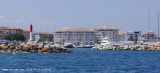

.jpg)