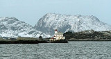
Stabben lighthouse is a leading ligthouse situated on an islet at the entrance to Florø in Flora municipality in Sogn and Fjordane. The lighthouse was commissioned in 1867. Lighthouse is notched and stands on a high stone wall and has a low roof tower. The tower was built higher ...
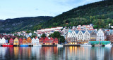
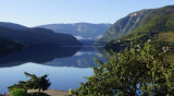
Bergen is one of the largest cruise ship ports of call as a point of departure to visit the world famous fjords of Norway. Bergen features a temperate oceanic climate. Bergen's weather is warmer than the city's latitude (60.4° N) might suggest. The Gulf ...


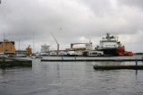


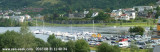
 Port.
Port.
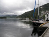
 Port côtier, escale de la ligne Hurtigruten.