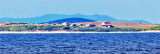
Luka Unije

Luka Unije

To precisely geolocate this site. Update if necessary.

Localisation

Characteristics

Port
First aid
Restaurant
West cardinal
Harbour

Description

Luka Unije
2008-07-16
Update
Luka Unije
2008-07-16
Update
Coming from the S it will take at least 0.3 M from the shore to avoid a shoal which borders the SW coast of Unije.
Luka Unije is accessed via N of HRID Skoljic, emerging rock 0.3 million N of Rt Nart, the tip S of the bay.
There is a shallow area between Rt Nart and HRID Skoljic. By night HRID Skoljic is covered by the area's red light Vnetak Rt.
From the N, beware of rocks on the NW coast of Otok Unije. W cardinal buoy indicates HRID Samuncel without fire.
We can moor along the pier the ferry, leaving free space when it should happen (hours posted on the bulletin board).
There are 3 m of water.

We can anchor in the bay to the W, SW or SE Ferry Pier by 6 m, sandy bottom of resilience.

Good protection of the N S E.
Exposed to winds from W and NW.
2011/07/31
Update
Jojo
En venant par le S on se tiendra à au moins 0,3 M du rivage pour éviter un haut-fond qui borde la côte SW d'Unije.
On accède à Luka Unije en passant au N de Hrid Skoljic, roche émergente à 0,3 M au N de Rt Nart, la pointe S de la baie.
Il y a une zone de hauts-fonds entre Rt Nart et Hrid Skoljic. De nuit Hrid Skoljic est couvert par le secteur rouge du feu de Rt Vnetak.En venant par le N, attention aux roches sur la côte NW de Otok Unije. Une bouée cardinale W sans feu signale Hrid Samuncel.

On peut s'amarrer le long du môle du Ferry, en laissant libre la place quand celui-ci doit arriver (horaires affichés sur le panneau d'affichage).

Il y a 3 m d'eau.

On peut mouiller dans la baie à l'W, au SW, ou au SE du môle du Ferry par 6 m, fond de sable de bonne tenue.

Bonne protection du N au S par l'E.

Exposée aux vents d'W et de NW.

2011/07/31
Update
Jojo
Ebook

Kvarner

  • 120 sites
  • 182 photos
  • publication date: 7 Jul 2023
  • .pdf file size: 69 Mb
Share your comments or photos on "Luka Unije"

Sites around Luka Unije

Flying distances - Direct line

Otok Unije

0.7nm
68°
Otok Unije, a long and irregular shaped island, lies with Rt Vnetak, its SW extremity, located 7 miles NNW of Otok Susak and at W from N O. Losinj from it is separated by Unijski Kanal.
The island consists of a chain of partly wooded hills and the summit, 132m high, stands in the ...
31 Jul 11
Jojo

Medulinski Zaljev

16nm
306°
This area is located between Cape Kamenjak SW Marler and heading to the N.
Seven small islands surrounded by rocks and shoals dot the entrance Medulinski Zaljev.
Four tags indicate isolated rocks in the W of the bay, their presence is uncertain.The chanel between Rt Munat et ...
26 Mar 11
Joëlle

Kanal Vela Vrata

30nm
Kanal Vela Vrata connects the N end of Kvarner to Rijecki Zaliv and leads between the N end of Otok Cres, on the E side, and the mainland coast, on the W side.
The channel is deep and clear, the bottom being formed of mud.
31 Jul 11
Jojo

Rt Prostina à Rt Od Volam

21nm
305°
Rt Prostina is located at the end of Fasanski Kanal and is the N point of Luka Pula entrance.
There are few bays between Rt Prostina and Rt Od Volam that defines N Premantura Peninsula.
2 Sep 11
Jojo

Zaljev Rasa

22nm
340°
The large natural inlet Zaljev Rasa offers the best protection of all sectors of the entire E coast of Istria, while the Bora blows strongly here. This bay is sinking into the earth near 6M, between Rt Ubac and Rt Mulac. The Rijeka Rasa flows into the bottom, creating a current that ...
5 Sep 11
Jojo

Otocici Srakane

4.8nm
139°
Otocici Srakane, consisting of two narrow islets, extends up to 3.7 miles SE of the SE extremity of Otok Unije.
These islets are partly wooded and steep-to.
Hrid Silo lies close SE of the SE islet.
A light is shown from a prominent structure, 10m high, standing on this rock.
1 Aug 11
Jojo