Luka Primosten

Luka Primosten

To precisely geolocate this site. Update if necessary.

Localisation

Characteristics

Port
Grass
Mooring buoy
Mooring
Sand
VHF canal 10, 16
Water
Phone
Electricity
Fuel sur la route principale au-dessus du village
First aid
WC
Market
Restaurant
Post
Bank
Beach
Pebble

Description

Luka Primosten
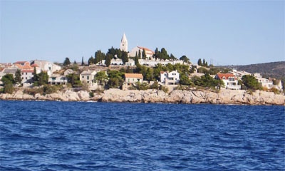
Primosten vue du large
2011-06-21
Update
Jojo
Luka Primosten
2011-06-21
Update
Jojo
Luka Primosten
2011-06-21
Update
Jojo
Luka Primosten
2011-06-21
Update
Jojo
Many islands (Barilac, Grbavac, Lukovnjak, and Maslinovik Smokvica) and islets clutter approach Primosten S and W, navigation must be especially cautious at night.
The village of Primosten on his island with the church on the hill is remarkable.
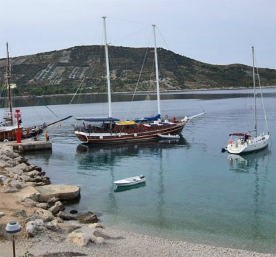
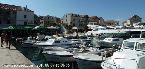
We moored perpendicular to the quay by 3 m outside the dock or inside by 2 m.
Sheltered harbor.
By strong winds from SW rough sea enters the bay.
Port of entry in summer.
2011/08/9
Update
Croatia
Luka Primosten
2011:08:09 16:35:16
2011-08-09
Update
Croatia
Luka Primosten
2011:08:09 16:36:44
2011-08-09
Update
Croatia
Ebook

Šibensko-kninska županija (Šibenik-Knin County)

  • 101 sites
  • 188 photos
  • publication date: 8 Aug 2024
  • .pdf file size: 65 Mb
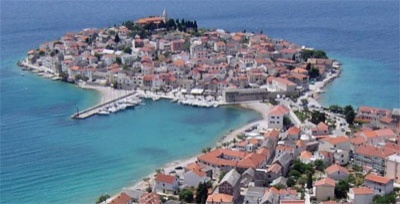
Primosten is a small town on an island that is connected to the mainland by a causeway and is surrounded by many small islands.
It is assumed that this region was inhabited in the 7th century BC. The city is known for its large and beautiful vineyards. In addition to vineyards, Primošten is also known for its traditional donkey race "TRKI Tovarov" which is held each summer.

The village is nice with old and narrows streets. A stop is required to visit Primosten.

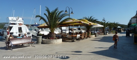
On the port a lot of restaurants. Outside a supermarket for food shopping.

Tel: 022 570266
Fax: 570149

2011/08/16
Update
Jo

Description

Primosten est une petite ville située sur une île qui est reliée au continent par une chaussée et qui est entourée par de nombreuses petites îles.

On suppose que cette région fut habitée au 7ème siècle avant JC. La ville est connue pour ses grands et beaux vignobles. En plus de ses vignes, Primošten est également connue pour sa traditionnelle course d’ânes « Trki Tovarov » qui est organisée chaque été.

La plus grande et la plus belle plage de Primosten est Raduča.

Il y a deux petits ports, une marina dans le village pour la plaisance et un port destiné à la pêcherie locale.

Tel: 022 570266
Fax: 570149

Sur le port on trouve de nombreux restaurants. Le village est à visiter. A l’extérieur de la vieille ville on trouve un supermarché pour se ravitailler.

Approche

De nombreuses îles (Barilac, Grbavac, Lukovnjak, Maslinovik et Smokvica) et îlots encombrent l'approche de Primosten au S et à l'W, la navigation doit se faire avec prudence surtout de nuit.

Le village de Primosten sur son île avec l'église sur la colline est remarquable.

On s'amarre perpendiculairement à la digue extérieure par 3 m ou au quai intérieur par 2 m.
Par forts vents de SW une mer forte rentre dans la baie.
Port d'entrée d'été.

2011/08/16
Update
Jo
Luka Primosten
Luka Primosten
2017-07-07
Update
Anonymous
Share your comments or photos on "Luka Primosten"

Sites around Luka Primosten

Flying distances - Direct line

Otok Zirje (Sibenik)

11nm
289°
Otok Zirje is the farthest and the largest island in the Sibenik archipelago.
It is long of 6,5 NM (NW/SE) and 1,4 NM wide.
The main village, Zirje, is located in the middle of the island. A small port, luka Muna, on the coast N of Zirje, home to the ferry that connects the ...
16 Aug 11
Croatia

Otok Ciovo

17nm
108°
Ciovo is an island in the center of the Dalmatian archipelago. This is an area of 28.8 acres (15.3 km length, width of 3.5 km). It culminates at 218 m (Mount Rudin).
O. Ciovo forms the SW side of the entrance and inner part of Kastelanski Zaliv.
At East side, Ciovo is 2km from ...
7 Aug 11
cdg2

Zlarinski Kanal

6.6nm
321°
Zlarinski Kanal leads along the SW side of Otok Zlarin and is entered midway between Rt Rat and Otocic Komorica, a small islet marked by a light, 1.5 miles SW.
This channel is sometimes used as an alternate route to Sibenik by vessels entering Sibenska Vrata, the middle passage, ...
21 Jun 11
Jojo

Otok Svetac (Andrija)

34nm
192°
Otok Svetac (Andrija), 305m high, lies 13 miles ESE of Otocic Jabuka and is generally steep-to. The coast of the island is rocky and reddish in color on the NW side. Its SW end is fronted by a few rocks. Hrid Kamik, a dark and jagged above-water rock, lies 0.7 mile W of the SW extremity ...
25 May 11
Jojo

Uvala Rogoznica

4.2nm
144°
Wide bay sheltered from all winds, with multiple opportunities for mooring anchor. A marina excellent high-end with all services but expensive.
In the middle of the bay lies the island, connected to the mainland by a causeway, on which the village of Rogoznica is built. An old ...
8 Aug 11
MamJo

Otok Zlarin Sibenik

6.9nm
329°
Otok Zlarin is 3.2 NM (NW / SE) by 1.2 nm and has only one village. Its highest point is Klepac (174 m).
Access to cars is prohibited.
It is located 2 km SW of Sibenik which it is separated by the Sibenski Kanal.
It has been inhabited since the Neolithic and was occupied ...
9 Jul 11
Jojo