Otok Zlarin Sibenik

Otok Zlarin Sibenik

To precisely geolocate this site. Update if necessary.

Localisation

Characteristics

Island / Atoll

Description

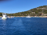
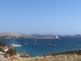
Otok Zlarin is 3.2 NM (NW / SE) by 1.2 nm and has only one village. Its highest point is Klepac (174 m).
Access to cars is prohibited.
It is located 2 km SW of Sibenik which it is separated by the Sibenski Kanal.
It has been inhabited since the Neolithic and was occupied by the Romans.
Zlarin is famous for its red coral . In summer, when many tourists are on the island, you can attend a ceremony held for the sailors who go to sea during the night to find corals.
Each year, the Yacht Club hosts three regattas Zlarin "Zlarinska krstaša regata", "Latinskin IDRUN kureja na" and the New Year "Zlarinska krstaša regata".
2011/07/9
Update
Jojo
Otok Zlarin fait 3,2 NM (NW/SE) par 1,2 NM et n'a qu'un seul village. Son point culminant est Klepac (174 m).
L'accès aux voitures est interdit.
Elle est située à 2 km au SW de Sibenik dont elle est séparée par le Sibenski Kanal.

Elle est habitée depuis le Néolithique et fut occupée par les Romains.

Zlarin est célèbre pour ses coraux rouges.  En été, quand beaucoup de touristes sont sur l'île, on peut assister à une cérémonie qui a lieu pour les marins qui vont à la mer pendant la nuit pour trouver des coraux.

Chaque année, le Yacht Club de Zlarin organise trois régates, «Zlarinska regata krstaša", "Latinskin IDRUN na kureja" et le Nouvel An "Zlarinska regata krstaša".

2011/07/9
Update
Jojo
Ebook

Šibensko-kninska županija (Šibenik-Knin County)

  • 99 sites
  • 182 photos
  • publication date: 7 Jul 2023
  • .pdf file size: 59 Mb
Ebook

Dalmacija (Dalmatie)

  • 542 sites
  • 910 photos
  • publication date: 9 Jul 2023
  • .pdf file size: 302 Mb
Share your comments or photos on "Otok Zlarin Sibenik"

Sites around Otok Zlarin Sibenik

Flying distances - Direct line

Otok Zirje (Sibenik)

7.5nm
253°
Otok Zirje is the farthest and the largest island in the Sibenik archipelago.
It is long of 6,5 NM (NW/SE) and 1,4 NM wide.
The main village, Zirje, is located in the middle of the island. A small port, luka Muna, on the coast N of Zirje, home to the ferry that connects the ...
16 Aug 11
Croatia

Zlarinski Kanal

0.9nm
219°
Zlarinski Kanal leads along the SW side of Otok Zlarin and is entered midway between Rt Rat and Otocic Komorica, a small islet marked by a light, 1.5 miles SW.
This channel is sometimes used as an alternate route to Sibenik by vessels entering Sibenska Vrata, the middle passage, ...
21 Jun 11
Jojo

Otok Murter

11nm
304°
The island of Murter is the largest island of the Sibenik archipelago. It is close to the coast on which it is connected by a bridge, low air draft at Tijesno (Tisno) on the continent. During the summer the bridge opens to allow passage of boats.
The NW part of the island is fertile ...
3 Apr 11
Jojo

Otok Kaprije (Sibenik)

6.2nm
275°
Kaprije is located in the central part of the Sibenik archipelago between the islands Zmajan and Kakan.
The highlight of the island is Vela Glavica (132 m).
The only village of the island is Kaprije, S. The port is busy.
Automobiles are not allowed on the island.
16 Aug 11
Croatia

Otok Svetac (Andrija)

39nm
185°
Otok Svetac (Andrija), 305m high, lies 13 miles ESE of Otocic Jabuka and is generally steep-to. The coast of the island is rocky and reddish in color on the NW side. Its SW end is fronted by a few rocks. Hrid Kamik, a dark and jagged above-water rock, lies 0.7 mile W of the SW extremity ...
25 May 11
Jojo

Otok Ciovo

22nm
120°
Ciovo is an island in the center of the Dalmatian archipelago. This is an area of 28.8 acres (15.3 km length, width of 3.5 km). It culminates at 218 m (Mount Rudin).
O. Ciovo forms the SW side of the entrance and inner part of Kastelanski Zaliv.
At East side, Ciovo is 2km from ...
7 Aug 11
cdg2