Luka Porec

Luka Porec

To precisely geolocate this site. Update if necessary.

Localisation

Characteristics

Port
Water
Electricity
First aid
Grocery
Post

Description

Luka Porec
2011-08-29
Update
Jojo
Luka Porec
2011-08-29
Update
Jojo
Luka Porec
2011-08-29
Update
Jojo
Ebook

Istrie (Istra)

  • 87 sites
  • 111 photos
  • publication date: 8 Aug 2024
  • .pdf file size: 50 Mb
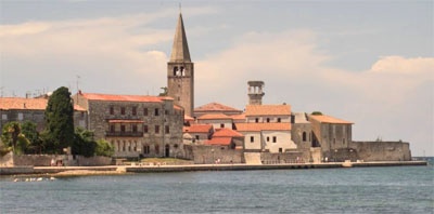
Porec is so popular that in July / August you must arrive early in the afternoon to be sure to find a place. 

The public transport part of Poreč  harbour is intended for the mooring, anchoring and sheltering of vessels with a draft of up to 4 metres, for the embarking and disembarking of passengers and loading and unloading of goods and other commercial activities.

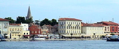
The operative part of the shore south-west of the Riviera hotel is used for mooring boats and small vessels and the embarking and disembarking of passengers and the loading and unloading of goods. From 20:00 in the evening until 06:00 in the morning, this part of the shore, and also the part of the shore south-east of the Riviera hotel, are used for mooring yachts and also boats involved in international traffic.

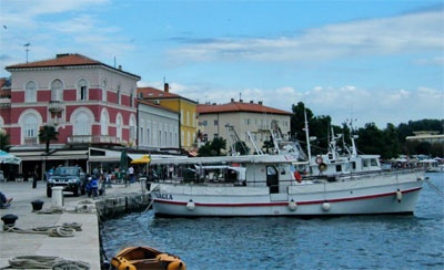
This is a permanent port of entry. For the formalities you moo along the pier to get to the N  dock where are the harbor's master and customs.

Good protection in the harbor.
2012/07/23
Update
Jojo
Porec est si prisé qu'en juillet/Août il faut arriver en début d'après-midi pour être sûr d'y trouver une place. 

Dans le port de Porec, la zone Transports publics est destinée à l'amarrage, l'ancrage des gros navires destinés à l'embarquement et le débarquement des passagers et le chargement et le déchargement des marchandises, avec un TE supérieur à 4 m.

La zone de la rive SW de l'hôtel Riviera est utilisée pour amarrer les bateaux de plus petites tailles et à l'embarquement et le débarquement des passagers et le chargement et le déchargement de marchandises.
De 20 h jusqu'à 6 h, cette partie de la rive, ainsi que celle du SE de l'hôtel Riviera, sont utilisées par les yachts et les bateaux de traffic international.

C'est un port d'entrée permanent . Pour accomplir les formalités on s'amarre le long du môle pour se rendre au quai N où se trouvent la capitainerie et les douanes.

Bonne protection dans le port.
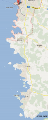
2012/07/23
Update
Jojo
Share your comments or photos on "Luka Porec"

Sites around Luka Porec

Flying distances - Direct line

Koperski Zaliv (Baia di Capodistria) Slovenia

20nm
10°
Koperski Zaliv (Baia di Capodistria) is entered between Rt Ronco and Rt Debeli, 5 miles NE.The NE and SW shores of the bay are hilly, but the shore at the head of the bay, through which the Fiume Risano flows, is low. Monte Sermino, surrounded by salt beds, rises isolated in the river ...
28 Aug 11
Jojo

De Porec au canal de Limski

2.8nm
187°
Warning: From Porec to the entrance to the Limski kanal there are a large number of dangerous shoals and rocks.
On the N side of Funtana bay is the Janjci shoal, its northern edge is marked by a black post with two red bands and topped with two black spheres.
At the southern ...
29 Aug 11
Jojo

Limski Kanal

6.7nm
146°
Limski Kana is entered between Rt Kriz, located 2.4 miles NW of Rovinj, and Rt Sjole, 1 mile NNW.
The Lim bay and valley is a peculiar geographic feature found near Rovinj and Vrsar on the western coast of Istria, south of Porec, Croatia.The Lim valley is the 35 km long valley ...
31 Aug 11
Jojo

Piranski Zaliv (Baie de Piran)

16nm
355°
The Gulf of Piran or Piran Bay (Slovene: Piranski zaliv, Croatian: Piranski zaljev or Savudrijska vala, Italian: Baia di Pirano) is located in the northern part of the Adriatic Sea, and is a part of the Gulf of Trieste. It is between Rt Madona at N and Rt Saudrija.
It was named ...
28 Aug 11
Jojo

De Rt Kriz à Rt Sv Eufemia

7.6nm
173°
From Rt Kriz (located S of Limski Kanal entrance), there are some shoals and islets. In front of Rt Muca are Figarola islet and Hr Figarolica at SW from it. Plic Muca, under 7/8 m of water, and Plic Skver, under 10 m of water, are off Rt Muca, NW of Uvala Valdenora, between Rt Muca ...
1 Sep 11
Jojo

Otoci Brijuni (îles Brioni)

19nm
160°
The Brijuni or the Brijuni Islands (also known as the Brionian Islands; Italian: Brioni) are a group of fourteen small islands in the Croatian part of the northern Adriatic Sea, separated from the west coast of the Istrian peninsula by the narrow Fazana Strait. The largest island, ...
2 Sep 11
Jojo