Krka river Pruklansko Jezero

Krka river Pruklansko Jezero

To precisely geolocate this site. Update if necessary.

Localisation

Characteristics

Sea

Description

Krka River northwest of Sibenik is 72 km long and covers 109 km ², the channel is simple and door lights.
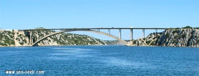
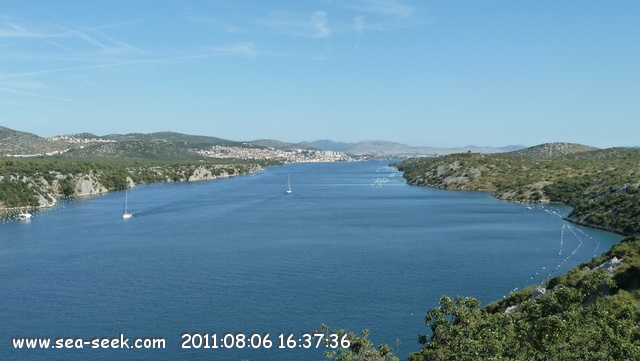
At about 2.5 nm ahead of Sibenik, a road bridge crosses the gorge, and just beyond there is a power line. Max air draft is 28 m under the bridge and the line. In this zone, shallow waters along the shores.
The river shrinks then and is divided into two parts.
NW arm towards the village of Zaton. This part is used for rowing races, there are buoys in the channel without fire.
The arm would lead to Prukjansko Jezero, Lake 2.5 NM 1 NM long and wide. Two power lines cross the channel before Prukjansko Jezero, their T. Air is over 29 m.
The lake shore is bordered by a shallow (1-8 m) dotted with rocks emerging or flush. Rocks along the shore in places.
You can anchor in various bays around the lake.
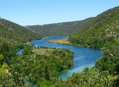
Krka river flows into the lake to the E. Up the river Krka to Skradin, the channel is again narrow and winding.
We can moor at the marina and Skradin visit the waterfalls in the appendix.
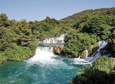
National Park Krka Falls has 7 along its route. The falls are from 200m to 400m in width and height of the drop is 45.7 m. It is a spectacle, magical! Krka Falls bounce off 17 benches of travertine constantly training. The site is considered the most beautiful karst of Europe.
Anchoring is prohibited in front of Skradin, but the authorities allow boaters to temporarily anchor the night must go to the marina.
The strength of the current in the river varies with the time of year.
In summer the current is negligible, but at other times of the year or after heavy rain, it can reach 3 knots in areas closest.
2011/07/4
Update
Jojo
Krka river   Pruklansko Jezero
Krka river Pruklansko Jezero
Pont de la rivière Krka
2011-07-04
Update
Jojo
La rivière Krka au NW de Sibenik est longue de 72 km et s'étend sur 109 km², le chenal est simple et porte des feux.
A environ 2,5 NM en amont de Sibenik, un pont routier franchit la gorge, et un peu au-delà il y a une ligne à haute tension. Le Tirant d'Air maxi est de 28 m sous le pont et la ligne. Dans cette zone, des hauts-fonds bordent les rives.

La rivière se rétrécit ensuite et se divise en deux parties.
Le bras NW mène au village de Zaton. Cette partie est utilisée pour des courses d'aviron, il y a des bouées sans feu dans le chenal.
Le bras NE mène à Prukjansko Jezero, lac de 2,5 NM de long sur 1 NM de large. Deux lignes électriques traversent le chenal avant Prukjansko Jezero, leur T. Air est de plus de 29 m.

Le lac est bordé par une rive peu profonde (1 à 8 m) parsemée de rochers émergeants ou affleurants. Des rochers bordent la rive par endroits.
On peut mouiller dans plusieurs baies abritées autour du lac.

La rivière Krka se jette dans le lac à l'E. En remontant la rivière Krka vers Skradin, le chenal est de nouveau étroit et sinueux.
On peut s'amarrer à la marina de Skradin et aller voir les cascades en annexe.
Le parc national de Krka compte 7 chutes le long de son parcours. Les chutes ont de 200m à 400m de largeur et la hauteur totale du dénivelé est de 45,7m. C'est un spectacle grandiose, féérique! Les chutes du Krka rebondissent  sur 17 bancs de travertin en constante formation. Le site est considéré comme le plus beaux ensembles karstiques d’Europe.

Le mouillage est interdit en face de Skradin, mais les autorités autorisent les plaisanciers à mouiller temporairement, la nuit il faut se rendre à la marina.

La force du courant dans la rivière varie suivant la période de l'année.
En été le courant est négligeable, mais à d'autres périodes de l'année ou après de fortes pluies, il peut atteindre 3 nœuds dans les zones les plus étroites.
2011/07/4
Update
Jojo
Krka river   Pruklansko Jezero
Krka river Pruklansko Jezero
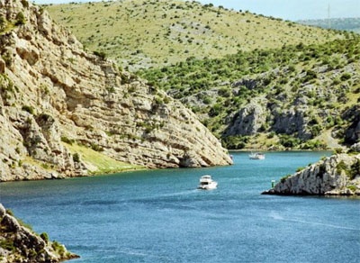
Le canal de Krka menant à Prukljansko Jezero
2011-07-04
Update
Jojo
Krka river   Pruklansko Jezero
Krka river Pruklansko Jezero
Une des cascades de Krka
2011-07-04
Update
Jojo
Krka river   Pruklansko Jezero
Krka river Pruklansko Jezero
Le lac Jezero et O. Stipanac
2011-07-04
Update
Jojo
Krka river   Pruklansko Jezero
Krka river Pruklansko Jezero
Guduca river
2011-07-04
Update
Jojo
Krka river   Pruklansko Jezero
Krka river Pruklansko Jezero
View from the bridge towards Sibenik.
2011:08:06 16:37:36
2011-08-14
Update
Croatia
Krka river   Pruklansko Jezero
Krka river Pruklansko Jezero
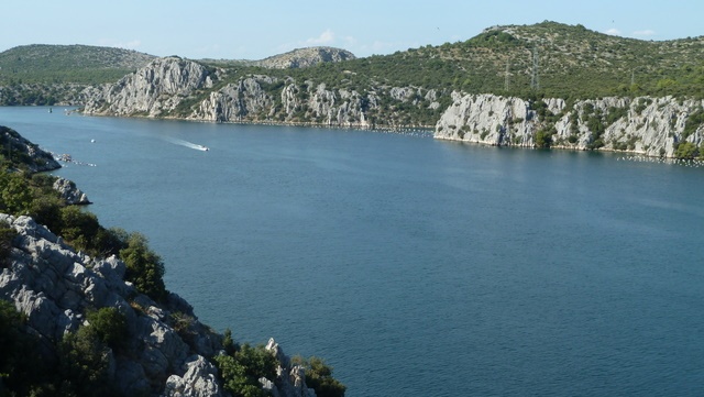
View north from the bridge.
2011:08:06 16:38:56
2011-08-14
Update
Croatia
Ebook

Šibensko-kninska županija (Šibenik-Knin County)

  • 99 sites
  • 182 photos
  • publication date: 7 Jul 2023
  • .pdf file size: 59 Mb
Share your comments or photos on "Krka river Pruklansko Jezero"

Sites around Krka river Pruklansko Jezero

Flying distances - Direct line

Otok Zirje (Sibenik)

11nm
224°
Otok Zirje is the farthest and the largest island in the Sibenik archipelago.
It is long of 6,5 NM (NW/SE) and 1,4 NM wide.
The main village, Zirje, is located in the middle of the island. A small port, luka Muna, on the coast N of Zirje, home to the ferry that connects the ...
16 Aug 11
Croatia

Otok Murter

10nm
271°
The island of Murter is the largest island of the Sibenik archipelago. It is close to the coast on which it is connected by a bridge, low air draft at Tijesno (Tisno) on the continent. During the summer the bridge opens to allow passage of boats.
The NW part of the island is fertile ...
3 Apr 11
Jojo

Zlarinski Kanal

7.3nm
192°
Zlarinski Kanal leads along the SW side of Otok Zlarin and is entered midway between Rt Rat and Otocic Komorica, a small islet marked by a light, 1.5 miles SW.
This channel is sometimes used as an alternate route to Sibenik by vessels entering Sibenska Vrata, the middle passage, ...
21 Jun 11
Jojo

Otok Zlarin Sibenik

6.5nm
188°
Otok Zlarin is 3.2 NM (NW / SE) by 1.2 nm and has only one village. Its highest point is Klepac (174 m).
Access to cars is prohibited.
It is located 2 km SW of Sibenik which it is separated by the Sibenski Kanal.
It has been inhabited since the Neolithic and was occupied ...
9 Jul 11
Jojo

Vrgadski Kanal

15nm
284°
Vrgadski Kanal, 7 miles long, leads between Otok Murter and Otok Vrgada and is the principal channel used in the S approach to Pasmanski Kanal and Zadar.
Vessels with a maximum draft of 6.4m may pass through Pasmanski Kanal. Vessels with drafts over 6.4m must either proceed through ...
16 Jul 11
Jojo

Otok Kaprije (Sibenik)

9.2nm
230°
Kaprije is located in the central part of the Sibenik archipelago between the islands Zmajan and Kakan.
The highlight of the island is Vela Glavica (132 m).
The only village of the island is Kaprije, S. The port is busy.
Automobiles are not allowed on the island.
16 Aug 11
Croatia