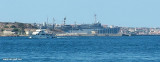
Isola La Maddalena (Arcipelago della Maddalena)
2.9nm
303°
It is connected by a bridge to Caprera island where are the house and the tomb of Garibaldi. ...
26 Nov 12
Joëlle
| Latitude | Longitude | |
| DMS | --- | --- |
| DM | --- | --- |
| DD | --- | --- |


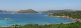
 Caprera Island is part of the Archipelago of La Maddalena, belonging to the municipality of La Maddalena, near the north-eastern coast of Sardinia.
")
 L' Île de Caprera fait partie de l'Archipel de la Maddalena, appartenant à la commune de La Maddalena, situé près de la côte nord-orientale de la Sardaigne.
Beau massif de rochers avec de jolies plages au S. Malheureusement toute cette partie est interdite aux civils: c'est un terrain militaire.
 L 'Isola Caprera fa parte dell'Arcipelago della Maddalena, appartenente al comune di La Maddalena, nei pressi della costa nord orientale della Sardegna.
Ebook | Sardegna North East
|
Ebook | Sardegna
|