Isla Grosa-Isolete El Farallon

Isla Grosa-Isolete El Farallon

To precisely geolocate this site. Update if necessary.

Localisation

Isla Grosa-Isolete El Farallon
LatitudeLongitude
DMS------
DM------
DD------

Characteristics

Island / Atoll
Mooring
Diving

Description

Isla Grosa-Isolete El Farallon
Isla Grosa-Isolete El Farallon (Murcie)
El Farallon et La Grosa, vue du NW.
2012-05-18
Update
Jojo
Isla Grosa-Isolete El Farallon
Isla Grosa-Isolete El Farallon (Murcie)
Isla Grosa
2012-05-18
Update
Jojo
Isla Grosa-Isolete El Farallon
Isla Grosa-Isolete El Farallon (Murcie)
El Farallon
2012-05-18
Update
Jojo
Ebook

Espagne Est - East Spain

  • 235 sites
  • 414 photos
  • publication date: 7 Jul 2023
  • .pdf file size: 180 Mb
Isla Grosa, 95m high, lies 1.5 miles offshore, 3.7 miles NNE of Punta de Calnegre. This island is high, steep-sided, and flat-topped. A light is shown from a structure standing on the summit.

Anchorage, sheltered from E winds, can be obtained by vessels with local knowledge, in a depth of 8.2m, weed, about 0.4 mile W of the island.


Islote El Farallon is located 0.4 mile E of the NE extremity of Isla Grosa. This islet is 22m high and has a sharp pointed summit. 
La Laja, a small rocky patch, lies about 0.3 mile NE of this islet and has a least depth of 1.3m.
2019/06/7
Update
Jojo
Isla Grosa, haute de 95m, se trouve à 1,5 MN au large, 3,7 miles au NNE de Punta de Calnegre. Cette île est haute, encaissée, et à sommet plat. Un phare se trouve sur le sommet.

Mouillage, à l'abri des vents E, pour des bateaux ayant des connaissances locales, à une profondeur de 8,2 m, sur algues, à environ 0,4 mile de l'île à l'W.

Islote El Farallon est situé 0,4 MN à l'E de l'extrémité NE de Isla Grosa. Cet îlot est haut de 22m et a un sommet pointu.

La Laja, un petit patch rocheux, se trouve à environ 0,3 mile au NE de cet îlot et a une profondeur minimale de 1,3 m.
2019/06/7
Update
Jojo
Share your comments or photos on "Isla Grosa-Isolete El Farallon"

Sites around Isla Grosa-Isolete El Farallon

Flying distances - Direct line

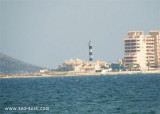
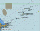
Islas Hormigas (Cabo de Palos-Murcia)

5.2nm
162°
Hormigas islands located in the region of Murcia, 2MN and a half from the coast.
Las Hormigas, formed by a chain of islets and rocky shoals, extends up to 3 miles NE of Cabo de Palos.

Islas Hormiga, the largest islet of this chain, lies 2.3 miles NE of the ...
7 Jun 19
Jojo

Punta del Estacio (Murcie)

1.6nm
314°
Punta del Estacio is located 7 miles NNW of Cabo de Palos. It is formed by the low and rocky SE extremity of a small peninsular which projects from the coast.
A light is shown from a tower, 29m high, standing on the point.

A coast guard hut and several other buildings are ...
18 May 12
Jojo

Puerto Tomas Maestre (Murcia)

2.2nm
300°
S of the Manga, strip of sand 22km long and 100-800 m wide, is the Port Tomas Maestre, along the Mar Menor.

Access to the marina from the Mediterranean, is through a channel of 1, 5 m with swing bridge (pairs every two hours during one quarter of an hour), which joins the sea ...
7 Jun 19
Jojo

Punta Calnegre ou De La Raja (Murcie)

3.9nm
191°
Punta de Calnegre (or De La Raja),  a rocky point partly covered with sand, is located 2.3 miles NW of Cabo de Palos. A rocky hillock, 43m high, stands close W of it.
Two marine farms, best seen on the chart, are located E of the point.
18 May 12
Jojo

Puerto Dos Mares (Murcie)

4.2nm
198°
Located in Las Palmeras bay, in front of Ciervo island, this harbour is connected at it by an isthmus. T. 968 140 117F. 968 140 117M.5 club2mares@yahoo.es270 pl. (<17 m)Caution the harbour has'nt marking at night, so it should be avoided boarding.
16 May 12
Jojo

Club nautico La Isleta (Murcie)

4.9nm
190°
Located 1,7 NM from Dos Mares marina and 1,9 NM from Mar de Cristal marina.T. 968 145 339F. 968 145 339Mail. admin@nauticolaisleta.net243 b. (<9 m)Depth: 1,85
16 May 12
Jojo