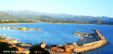

Arbatax marina di Arbatax (Sardegna)
0.4nm
105°
10 Oct 12
Joëlle
| Latitude | Longitude | |
| DMS | --- | --- |
| DM | --- | --- |
| DD | --- | --- |

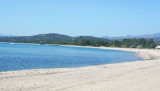
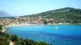
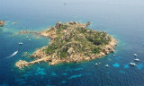
 Gulf di Tortoli is entered between Isola dell’Ogliastra and Capo Bellavista, marked by a light, 2.5 miles S.
Winds from the NW and NE quadrants come up suddenly and blow with extreme violence in this vicinity.
They may last for 4 or 5 days and are preceded by whitish clouds which cover the peak of Monte Santu.
Winds from the SW quadrant, which also blow with great force, may be forecast by low clouds on the slopes of the mountains around Ogliastro.
With these wild winds, the sea rapidly becomes rough and constitutes a danger for vessels in the harbors. In summer, rather weak SE winds prevail and are preceded by a dense mist over all the SE quadrant.
 Le golfe de Tortoli s'étend entre l'île de l'Ogliastra et le cap Bellavista, marqué par un phare, à 2,5 MN au S.
Les vents de NW et de NE se lèvent subitement et soufflent avec une extrême violence dans ce secteur.
Ils peuvent durer pendant 4 ou 5 jours et sont précédés par des nuages blancs qui couvrent le sommet du Monte Santu.
Les vents du SW, qui soufflent aussi avec une grande force, peuvent être précédés de nuages bas sur les pentes des montagnes autour de Ogliastro.
Avec ces vents sauvages, la mer devient rapidement rude et constitue un danger pour les navires dans les ports. En été, les vents de SE dominants sont plutôt faibles et sont précédés par par un épais brouillard au SE.
 Il golfo di Tortoli si trova tra l'isola di Ogliastra e il capo Bellavista, segnato da un faro, 2.5 MN al S.
Venti NW e NE alzarsi improvvisamente e soffiano con estrema violenza in questo settore.
Possono durare per 4 o 5 giorni e sono preceduti da nuvole bianche che coprono la cima del Monte Santu.
Venti SW, che soffiano anche con grande forza,possono essere preceduti da nubi basse sui pendii delle montagne intorno a Ogliastro.
Con i venti selvaggi, il mare diventa agitata rapidamente ed è un pericolo per le navi nei porti. In estate, i venti prevalenti SE sono piuttosto deboli e sono preceduti da un SE fitta nebbia.
Ebook | Sardegna East
|