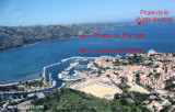
Ecueil de Tegnosa, a rocky bank with parts nearly awash, lies about 0.3 mile W of the citadel at Saint-Florent and is marked by a lighted beacon, 8m high.
A rocky patch, with a least depth of 1.7m, lies about 0.2 mile NE of the beacon.
2012/05/6
Update
Jojo
L'écueil de Tignosu, un haut-fond rocheux en partie émergé, s'étend sur environ 0,3 MN à l'W de la citadelle de St Florent et est marqué par une balise lumineuse de 8 m de haut. Un haut-fond rocheux, s'étend à une profondeur de 1,7 m, à 0,2 NM au NE de la balise.
Capo Sagro is located at 11 NM. S Finocchiarola islands. He has a signal station and a semaphore rises N of it. Mount Merizatodio, 778 m high, is 1.5 MN to W Cape and dominates the immediate area.
The village of Erbalunga, situated 1.5 miles SSW of Capo Sagro, stands on the S ...
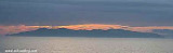
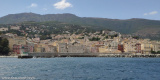
The Gulf of Saint Florent form a large body of water open to the North to NW winds, but sheltered by the mountains Libeccio of Balagne. Strong wind blows from east sometimes jump off the mountain which is extended by the Cap Corse and a rise in the Gulf chop rather unpleasant.
The ...
Capraia is one of the seven islands of the Tuscan Archipelago, on the road between Cape Corsica and Elba. It is an island of 335 inhabitants (the Capraiesi) of the Province of Livorno. It lies 64 km from Livorno, 37 km from Gorgona and 31 km from Corsica. Its area is 19 km2. It has ...
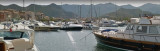
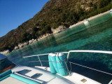
An extensive yacht and small craft harbor fronts the village of Saint-Florent and is protected by breakwaters.
Amer remarkable red beacon at 400m. of the harbor entrance (pitfall of Tignoso), red lights shine 2s. Access: Easy day and night.
Harbour with 840 berths including ...
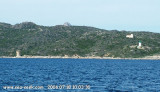
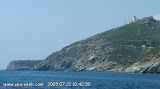
Cap Fornali, surmounted by an old tower, is located on the W side of the gulf, 1 mile from the head. A light is shown from a structure, 9m high, standing on the cape. Anchorage is available, in depths of 11 to 12m, sheltered from all but N winds, in a roadstead lying 0.3 mile ...
The river Santu is a stream of Haute-Corse region of Corsica, which flows into the Mediterranean Sea to the western Gulf of Saint-Florent, S of the tip of Mortella. Approach slowly anchorage area. We anchor by 3 to 6 m.
Very sheltered anchorage by W wind, but exposed to the Mistral.


 L'écueil de Tignosu, un haut-fond rocheux en partie émergé, s'étend sur environ 0,3 MN à l'W de la citadelle de St Florent et est marqué par une balise lumineuse de 8 m de haut.
")
")
")