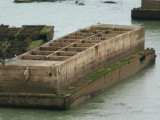

Port Winston - Arromanches
6.1nm
279°
Mary stands on the crest of a hill close E of this village.
The caissons and wrecks of Port Winston, a former artificial harbor used for the Allied landings during WWII, front the ...
7 May 12
Geof
| Latitude | Longitude | |
| DMS | --- | --- |
| DM | --- | --- |
| DD | --- | --- |

 Canal 9


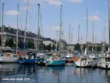
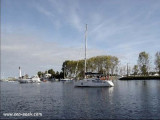
 Courseulles-sur-Mer is a small harbor lying at the mouth of the Riviere Seulles. It is used by small fishing vessels and pleasure craft. The harbor consists of an avant-port leading to a wet dock and a tidal basin. The approach channel is indicated by a lighted range and dries 3.5m. Local knowledge is advised. The entrance, with a least width of 27m, lies between a jetty and a breakwater.

Ebook | Manche - English Channel
|