It is the largest island of the archipelago composed of sixty islets and 7 major islands, in the NE end tip of Sardinia. It is mountainous and arid. This is the only inhabited island thoroughly. It is connected by a bridge to Caprera island where are the house and the tomb of Garibaldi. ...
Gulf of Arzachena (Arsachena), located between Punta Saline and Tre Monti Cape, is a high inlet whose banks are lined with shoals. S tip, Arzachena, W of the entrance, a beacon consists of an iron post with a sheer spherical white marks a rock particularly ...
La tourelle Pecorella marque l'entrée de ce golfe qui s'enfonce à plus de 4 M dans les terres. Celle de Chiapino qui était plus au S est démolie. Il faut donc remonter suffisamment vers le N pour ne pas risquer d'en toucher les restes. En piquant vers l'W, la balise noire délimite ...
A little less than 1 NM to the E of Ventotene island, there is the island of Santo Stefano, the smallest of the archipelago.
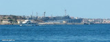
This island is occupied by the army. Currently there is a NATO base on the island of Santo Stefano. The NATO base housed an Italian Marine barracks ...
A la point SE, la punta Rossa avec une balise verte à passer au sud. Les abords d'un ancien fort militaire sont interdits. Passage entre l'isola des Bisce et Capo Ferro en venant de l'ouest. Passage entre l'isola des Bisce et Capo Ferro en venant de l'ouest. Port Palma ...


")

")
")