Insolite et difficile à trouver, on pourra s'arrêter dans la cala Brigantino. Fonds de roches et de sable, cette cala étroite et profonde permet un mouillage par 3 m de fond avec une ancre et un bout à terre. Attention à la roche sous 1 m d'eau au fond à la hauteur de la petite anse au nord.
2011/06/27
Update
Jojo
Inusuali e difficili da trovare, si può fermare in cala Brigantino. Fondo di roccia e sabbia, la cala stretta e profonda permette ancorare da 3 m di profondità con un'ancora e un end-to-terra. Attenzione alla roccia sotto 1 metro d'acqua nella parte inferiore per l'altezza della piccola insenatura a nord.
It is the largest island of the archipelago composed of sixty islets and 7 major islands, in the NE end tip of Sardinia. It is mountainous and arid. This is the only inhabited island thoroughly. It is connected by a bridge to Caprera island where are the house and the tomb of Garibaldi. ...
Gulf of Arzachena (Arsachena), located between Punta Saline and Tre Monti Cape, is a high inlet whose banks are lined with shoals. S tip, Arzachena, W of the entrance, a beacon consists of an iron post with a sheer spherical white marks a rock particularly ...
La tourelle Pecorella marque l'entrée de ce golfe qui s'enfonce à plus de 4 M dans les terres. Celle de Chiapino qui était plus au S est démolie. Il faut donc remonter suffisamment vers le N pour ne pas risquer d'en toucher les restes. En piquant vers l'W, la balise noire délimite ...
A little less than 1 NM to the E of Ventotene island, there is the island of Santo Stefano, the smallest of the archipelago.
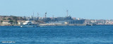
This island is occupied by the army. Currently there is a NATO base on the island of Santo Stefano. The NATO base housed an Italian Marine barracks ...
Anse au nord de la Punta Cotticio, vue du NE La Cala Cotticio au sud de lapointe Cotticio est composée de deux anses bien abritées du nord où l'on mouillera par 10 à 15m de fond. L'anse la plus occidentale est entourée de hautes falaises et il faut aller tout près ...
SW of Corsica offers some of the most beautiful anchorages. As you get closer to Bonifacio be carreful with the weather forecast as the NW wind can be very strong.
The range of the tide in this area is negligible. There are no regular currents along the coasts of Corse, ...


 Insolite et difficile à trouver, on pourra s'arrêter dans la cala Brigantino.
 Inusuali e difficili da trovare, si può fermare in cala Brigantino.
") Vue de l'E
Vue de l'E