Pointe de la Coscia, located 1 mile S of Sommet Tamarone, is the S entrance point of Baie de Tamarone. This bay is 0.7 mile wide and affords shelter from W winds.
Surrounded by a beautiful sandy beach is a pleasant good weather anchorage.
2012/05/1
Update
Jojo
La pointe de la Coscia, située à 1 NM au S du sommet de Tamarone, est le point S de l'entrée de la baie de Tamarone.
Cette jolie baie est large de 0,7 NM et abritée des vents W. Entourée d'une belle plage de sable, c'est un mouillage agréable pour la journée.
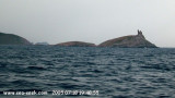
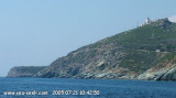
Capo Sagro is located at 11 NM. S Finocchiarola islands. He has a signal station and a semaphore rises N of it. Mount Merizatodio, 778 m high, is 1.5 MN to W Cape and dominates the immediate area.
The village of Erbalunga, situated 1.5 miles SSW of Capo Sagro, stands on the S ...
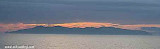
Capraia is one of the seven islands of the Tuscan Archipelago, on the road between Cape Corsica and Elba. It is an island of 335 inhabitants (the Capraiesi) of the Province of Livorno. It lies 64 km from Livorno, 37 km from Gorgona and 31 km from Corsica. Its area is 19 km2. It has ...
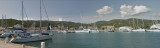
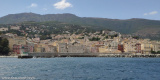
Macinaggio, a village, is situated in a bay which is entered S of Pointe de la Coscia. It is fronted by a small harbor which is protected by two jetties and has extensive facilities for small craft and yachts. The harbour is not sheltered from wind. T. 04 95 35 42 57 F. 04 95 35 ...
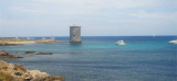
Finocchiarola islands, previously connected at the Corsica, consists of
three islets which are surrounded by rocks. A ruined tower stands on the
E and largest islet. They are distinguished by their peculiar fauna
as well as rare endemic plants. They are home to several species ...
Located between Marines de Sisco and Erbalunga, this point is well known to divers. Cape Sagro is an anchorage where the ancient Roman fleet landed the goods for this part of Cap Corse.
This site is of outstanding beauty and it is not unusual to see diving teams of experienced ...


 Pointe de la Coscia, located 1 mile S of Sommet Tamarone, is the S entrance point of Baie de Tamarone. This bay is 0.7 mile wide and affords shelter from W winds.
 La pointe de la Coscia, située à 1 NM au S du sommet de Tamarone, est le point S de l'entrée de la baie de Tamarone.