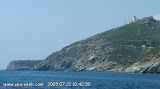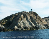
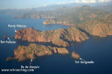

Reserve naturelle de Scandola - Natural Park of Scandola
11nm
211°
15 May 12
dd
| Latitude | Longitude | |
| DMS | --- | --- |
| DM | --- | --- |
| DD | --- | --- |


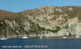
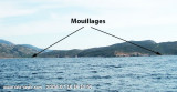
 N cap CAVALLO, Nichiareto bay offers a suitable anchorage by Libeccio, but none by Mistral.
 Au Nord du Cap CAVALLO, la baie de Nichiareto offre un mouillage convenable par Libeccio, mais nul par Mistral.
Il est recommandé de jeter l'ancre soit en avant de la plage par 6 à 7m sur fond de sable, de roches et d'algues, soit juste dans l'Est de la petite pointe Bianca où la protection contre le Libeccio est la meilleure.
Les fonds de sable et d'herbes sont de moyenne tenue mais la profondeur ne dépasse pas 6 à 8m sur un large platin en avant de la plage.
L'anse au Nord du rocher de 16m est ouverte à la houle et à presque tous les vents. Aussi le mouillage est-il dangereux.
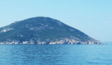
Tout autour de l'anse de Nichiareto, le massif montagneux est très sauvage.

Ebook | Ouest Corse - West Corsica
|