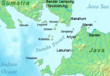

Strait of Malacca (East)
428nm
320°
25 Jan 12
Jojo
| Latitude | Longitude | |
| DMS | --- | --- |
| DM | --- | --- |
| DD | --- | --- |

 On the W coast of Sumatera there is a high, rocky coast, or if there is a strip of sand by the sea, the land rises rapidly behind it to the neighboring hills.
The route to the W of all the islands, in the open sea, is thebest of the three, especially for vessels not intending to touch at any of the W coast ports.
The middle route is the space between the chain of large islands in the offing and those small islands adjacent to and interspersed along the coast. It ranges from 10 to 30 miles distance from the coast of Sumatera.The inner route is that close along the coast and between some of the islands and dangers off it. Like the middle route, it should seldom be chosen; but as there are in many places moderate depths for anchoring, it is preferable in that respect to the middle route.
Vessels visiting many of the ports are obliged to use it, but considerable risk is run when taking this route at night; those using it are generally obliged to anchor at sunset.
The influence of the Southwest Monsoon and the Northeast Monsoon are felt on the W coast of Sumatera as far S as 2°N, S of the Indian Ocean monsoons, but from Ujung Raya to 4°N the winds are quite different from those between 4°N and 2°N.
Between Ujung Raya and 4°N, the Southwest Monsoon prevails from May to October, and the Northeast Monsoon, from December to March. During the height of the Southwest Monsoon, the sea breeze prevails at times during the night. Generally speaking the land winds are clearly perceptible by the deflection of the wind to SE or N during the night. Squalls are frequent during the monsoon, and there is often a considerable sea along this coast. It is somewhat hazy at times.
The Northeast Monsoon period is from December to March, and it is less strongly marked. When the monsoon has fairly set in, there is usually a gentle S breeze in the morning, followed by a calm, and in the afternoon a light breeze. After sunset comes, the land wind prevails all night. Between 4°N and 2°N is the region of calms and light variable winds.
The influence of the monsoons only appears in a W tendency of the day wind from March to November, and an E tendency from November to March; at night, except in January and February, there is always a N tendency in the wind.
In April, SW and NW winds are most prevalent, both night and day. From May the NW winds become more prominent.
During the following months they increase and reach their maximum in October; at times these winds cause a considerable sea. August is marked by a frequency of NE winds. At night, the winds from May to November are from NW to NE.
From November to January, the wind is variable in the daytime; at night it is generally from NE to E.
The tides on the W coast of Sumatera are chiefly semi-diurnal in character and of small range, rarely exceeding 1.2m.
The current off the W coast of Sumatera sets mainly NW at a maximum rate of 2 knots near the 200m curve. It seldom sets SE, but may sometimes set onshore. Beyond 8 miles from the coast, the surface current caused by the wind attains a maximum rate of 1.25 knot with NW winds and 1 knot with SE winds.
North of the Equator, the current outside the islands may sometimes be the reverse to that flowing between the islands and the coast.
Pilotage is compulsory for all the ports of the Republic of Indonesia at which pilots are available.
Experience has shown that little confidence should be placed in the natives who offer themselves as pilots on the W coast of Sumatera for ports seldom visited. Signals for a pilot are in accordance with the International Code of Signals.
An extensive prohibited area, in which fishing and other activities not associated with the innocent passage of foreign vessels, has been established off the coastline of northwestern Sumatera and is bounded by lines joining the following positions: a. 2°05.6'N, 96°38.0'E. (Pulau Babi) b. 1°55.0'N, 96°29.0'E. c. 2°51.0'N, 95°13.9'E. d. 2°57.0'N, 95°11.0'E. e. 4°48.0'N, 95°10.0'E. f. 5°43.2'N, 94°46.5'E. g. 5°51.0'N, 94°46.7'E. h. 6°13.5'N, 94°59.5'E. i. 6°16.0'N, 95°10.1'E. j. 5°40.4'N, 96°00.5'E. k. 5°29.0'N, 96°49.4'E. l. 5°29.2'N, 97°33.5'E. m. 5°01.0'N, 98°03.4'E. n. 4°33.8'N, 98°25.9'E. (Ujung Tamiang)
This prohibited area does not apply to foreign vessels supporting offshore terminals. Mariners should consult with local authorities for further information.
Caution:
The coastline is deeply indented, forming numerous bays, none of which, however, N of Sibolga, afford complete shelter during the Southwest Monsoon.
There are many visible and sunken dangers off the coast, but N of Ujung Raja, they do not extend to any great distance. South of that point they extend from 20 to 30 miles.
Many dangers no doubt exist that are not charted; caution is necessary at all times. Many of them are steep-to coral reefs, so that soundings will give no warning; a good lookout aloft should be kept during daylight, and vessels should proceed only at a moderate speed when navigating in the vicinity of dangers. Soundings, however, should not be neglected.
As a result of cataclysmic damage created by the tsunami of 26 December 2004, ports in this sector may be closed; depths, sea bed topography, and buoyage may not be as charted. Mariners are urged to contact local authorities for the latest information.
Ebook | Sumatra (Indonesia)
|