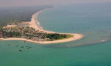
Pulau Nias, the largest of the islands at 125 km off the W coast of Sumatera, is hilly and from E appears like a chain of mountains of varying height. It has hardly any conspicuous peaks, but Maziaja Mountain, 432m high in the N portion, is noticeable along with three somewhat lower peaks. Nias is 130 km long and 45 km wide. From the W, the hills along the coast are seen to better advantage and afford good landmarks in conjunction with the islands fronting the coast. From S, the headlands provide the best marks.
Legendary for surfing, this island once hosted a World Surfing Championship
round. The
capital of Nias is Gunung Sitoli. The airport is located 19km from Gunung
Sitoli and the sea port is 5km.
The E coast of Pulau Nias has moderate depths with good anchorage and some streams; islets and reefs front the coast here, as on the W side, but the sea being smoother on the E coast renders it safer.
Off the coast of Nias lie 2
other islands - Pulau Bawa and Pulau Aru. Pulau Bawa is excellent for
surfing. The W coast of Pulau Nias is nearly inaccessible
because of surf Tanjung Sosilutte, about 2 miles SE of Tanjung Tojolawa,
is a low point with a remarkable tree, and ...
Pulau Wunga, about 8 NM S of Pulau Mausi, is low andcovered with coconut trees. A large conspicuous tree, visible for 16 miles, is located on a small elevationnear the N end. The reef extending from the N side of the island is ordinarily marked by high rollers; on the S side ...
Tanjung Sirombu, lying about 34 miles SSE of Tanjung Sosilutte, is low and wooded and may be identified by several tall casuarina trees which stand above the other trees. The point is marked by a light. From a distance it resembles an island, but from closer in the low wooded sandy ...
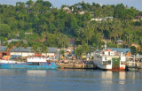
Gunung Sitoli (Gunungsitoli is the capital and the port of Nias. It is located about 14 NM NW of Tg Lambaru and forms a deep bight. At its head the hills approach the shore, leaving a strip of lowland between them. 6.29 The mouth of the river, leading to the port, will just ...
North of Gunungsitoli, the coast is covered with coconut trees for about 6 miles.Close N of Gunungsitoli is Tanjung Mbaa, a rocky point from which a light is shown. From Tanjung Mbaa, a narrow strip of coast land extends about 3 miles NW, then a fringing reef leads up to Tanjung ...


 Pulau Nias, the largest of the islands at 125 km off the W coast of Sumatera, is hilly and from E appears like a chain of mountains of varying height. It has hardly any conspicuous peaks, but Maziaja Mountain, 432m high in the N portion, is noticeable along with three somewhat lower peaks. Nias is 130 km long and 45 km wide.