Pulau Simeulue (W Sumatra)

Pulau Simeulue (W Sumatra)

Per individuare con precisione. Aggiornare se necessario.

Localizzazione

Pulau Simeulue (W Sumatra)
LatitudeLongitude
DMS------
DM------
DD------

Caratteristica

Isola / Atoll
Surf
Sub

Descrizione

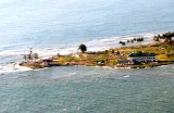
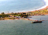
Pulau Simeulue, the northernmost of the large islands off 150 km of the W coast of Sumatera, lies about 65 miles from the coast.
It is hilly with Sibau, the highest peak being 625m high.
The coasts are mostly rocky, and there are many off-lying islands, islets, and reefs.
The reefs close to and between the several coral islets are steep-to and, except those near Pulau Sioemat, on the NE side of the island, show up distinctly.

The depths around the island vary greatly, so the soundings give little warning of the approach of land; a good lookout from aloft is advisable. Earthquakes and seismic sea waves occasionally occur, but minor shocks are frequent.

Surfers will find excellent reef breaks at various locations around the island.

2012/02/4
Aggiornare
Jojo
Ebook

Sumatra (Indonesia)

  • 326 sites
  • 109 photos
  • publication date: 7 Aug 2024
  • .pdf file size: 109 Mb
Condividi i tuoi commenti o le foto su "Pulau Simeulue (W Sumatra)"

Siti intorno a Pulau Simeulue (W Sumatra)

Flying distances - Direct line

Pulau pulau Kokos (W Sumatra)

56nm
302°
The Kokos Islands are two low islands, lying about 24 miles W of the N extremity of Pulau Simeulue.
They may be seen from a distance of about 13 miles. The southernmost island is marked by a light.
Depths of from 9 to 16.5m exist on the NW end of the bank extending 19 miles ...
4 Feb 12
Jojo

Pulau Wunga (W Nias)

92nm
144°
Pulau Wunga, about 8 NM S of Pulau Mausi, is low andcovered with coconut trees.
A large conspicuous tree, visible for 16 miles, is located on a small elevationnear the N end.
The reef extending from the N side of the island is ordinarily marked by high rollers; on the S side ...
6 Feb 12
Jojo

Ujung Raja (Susoh - W Sumatra)

78nm
14°
Between Meulaboh and Ujung Raja, about 34 miles SE, the coast is low, with high trees behind. There are no off-lying dangers until about 12 miles SW of Ujung Raja and the soundings give good warning of approach to the coast.
The mountains lie far inland and are only visible in ...
4 Feb 12
Jojo

Ujung Karang (Kareueng) (W Sumatra)

100nm
357°
The coast between Ujung Toeba (Ujung Tuba), a low promontory, and Ujung Kareueng, about 8 miles SE, is swampy.
Ujung Kareueng, the W extremity of Meulaboh Bay, is a low point sparsely covered with coconut trees with buildings of a settlement on it; a light is shown from Ujung Kareueng. ...
4 Feb 12
Jojo

Meulaboh harbour (W Sumatra)

100nm
357°
Meulaboh Bay affords less protection, there being no reefs seaward.
The shore of the bay is fronted by a reef which extends 91m off Kuala Tjangku.Meulaboh is the capital of W Aceh Regency and is among the hardest hit areas by the 2004 Indian Ocean earthquake. Being just 150 km ...
4 Feb 12
Jojo

Ujung Singkil (W Sumatra)

94nm
96°
Ujung Singkil, 8.5 miles SSE of Oedjoeng Pasir Gala (Ujung Pasirgala), may be identified by some dead trees standing in the sea close off it.
From it a spit, with depths of from 1.8 to 5.5m, extends about 3 miles SW.
North Daphne Reef (Karang Rumambi), with a depth of 1.5m, ...
4 Feb 12
Jojo