Pulau Wunga, about 8 NM S of Pulau Mausi, is low andcovered with coconut trees. A large conspicuous tree, visible for 16 miles, is located on a small elevationnear the N end. The reef extending from the N side of the island is ordinarily marked by high rollers; on the S side is marked by rollers or breakers.
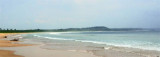
Pulau Mausi, low and barren, lies in the S approach to Labuan Atjeh, about 2.2 miles SE of Tanjung Sosilutte. It has a white sandy beach, and is fringed by a reef onwhich the sea always breaks, extending about 1 mile S; there is a depth of 7.7m at the outer end of the reef. An ...
Labuan Atjeh, on the E side of the peninsula, affords sheltered anchorage during N winds, in depths of from 18.3 to 21.9m, sand. A 1.2m patch lies on the E side of the bay, about 0.3 mile offshore.
Tanjung Sosilutte, about 2 NM SE of Tg Tojolawa, is a low point with a remarkable tree, and it is the S extremity of the Tojolawa Peninsula, on the slopes of which are the buildings of a coconut plantation.
From Pulau Senau, lying about 11 miles ENE of Tanjung Tojolawa, the coast is completely exposed to N and NW squalls. They are prevalent here during the months of October, November, and the first part of December; they may be exceptionally heavy and cause a heavy swell and much ...
The N coast of Pulau Nias, which forms the S side of Pulau Nias North Channel, is low, but there is a range of hills extending S from Tanjung Siginingini, the N extremity of the island, to Maziaja Mountain.


 Pulau Wunga, about 8 NM S of Pulau Mausi, is low andcovered with coconut trees.