Tanjung Padang (E Sumatra)
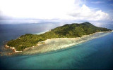
Dedap, a wooded islet, lies on a sandbank which extends about 0.2 mile offshore ...
| Latitude | Longitude | |
| DMS | --- | --- |
| DM | --- | --- |
| DD | --- | --- |

 Pulau Bengkalis is uniformly covered with vegetation. Its N coast is fronted by shallow ridges running parallel to it and separated by deeper channels.
The village of Bantantengah lies about midway between Tanjung Jati and Tanjung Parit, the NE end of the island. During May and November numerous fishing boats frequent the waters N of the island.
A shoal, with a depth of 3.9m, lies on a ridge about 7 miles N of Bantantengah.
The E coast of Pulau Bengkalis is fringed by a steep-to bank of mud and sand extending about 0.3 mile offshore. A river discharges into the strait about 2 miles S of Tanjung Senekip, which lies 3.75 miles SSE of Tanjung Parit.
A shoal, with a depth of 8.5m, lies 2.5 miles offshore 4.5 miles SE of Tanjung Senekip.
A shoal, with depths of less than 10m, lies centered 1.5 miles offshore between Tanjung Senekip and Tanjung Pulau Kandar.
The tidal currents set along the N side of Pulau Bengkalis and Pulau Rangsang, to the SE, in an E to ESE direction at a rate of 2 knots at springs, and from W to NW at a rate of 3 knots.
At neaps, both currents are weak off Pulau Bengkalis, but have a rate of from 1 to 1.5 knots off Pulau Rangsang.
In the bight between these two islands, the current sets in and out.
In Selat Bengkalis, the SE current begins about 2 hours after LW along the shore and may attain a rate of more than 2 knots.
The NW current begins 2 hours after HW and at times attains a rate of 3 knots.
The current near the E coast of Pulau Bengkalis has a rate of almost 2 knots and increases to a rate of 3.5 knots near Pulau Belembang and Pulau Burung.
A vessel bound for Bengkalis Settlement from the Strait of Malacca may pass close along the E side of Pulau Bengkalis, round its SE end, taking care to avoid the spit which extends from it, and then proceed through Selat Padang.
Ebook | Sumatra (Indonesia)
|


