Pulau Batu Besar (Malacca - Malaysia)

Pulau Batu Besar (Malacca - Malaysia)

Per individuare con precisione. Aggiornare se necessario.

Localizzazione

Pulau Batu Besar (Malacca - Malaysia)
LatitudeLongitude
DMS------
DM------
DD------

Caratteristica

Faro

Descrizione

Pulau Batu Besar, 4.6m high, stands 1.25 miles offshore, 7 miles SE of Batu Tengah. A sandy ridge, with depths of 6.1 to 9.7m, lies from 0.5 to 2 miles NW of the rock.

A shoal with a depth of 16.3m, lies 3.5 miles WSW of Pulau Batu Besar.

Two white towers, each about 34m high, stand about 2 miles ENE of Pulau Batu Besar.

There is no safe passage for vessels without local knowledge between Pulau Batu Besar and the mainland as the area is fouled by rocks, some above-water.

The sea is discolored by rips, which do not necessarily coincide with the shoals.

A rocky shoal, with a depth of 3.4m, lies almost 1 mile E of Pulau Batu Besar.

2012/01/2
Aggiornare
Jojo
Ebook

Strait of Malacca (East)

  • 83 sites
  • 69 photos
  • publication date: 11 Jul 2023
  • .pdf file size: 35 Mb
Condividi i tuoi commenti o le foto su "Pulau Batu Besar (Malacca - Malaysia)"

Siti intorno a Pulau Batu Besar (Malacca - Malaysia)

Flying distances - Direct line

Water islands (Malacca - Malaysia)

19nm
128°
Between Melaka and Tanjong Seginting, about 46 miles SE, the low, thickly wooded coast is bordered by a mud bank which extends up to 2.5 miles offshore in places.
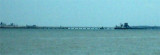
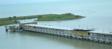
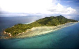
The Water Islands, centered about 8 miles SE of Melaka, consists of a group of six tree-covered islands of moderate ...
5 Jan 12
Jojo

Pyramid shoal (Malaysia)

30nm
286°
Pyramid Shoal, which lies on the N side of the SE end of South Sands, has a least depth of 3.4m, hard sand, and is the most dangerous shoal in the area because of its depth and protrusion into the fairway.
A lighted buoy is moored about 7 miles SE of Pyramid Shoal. A depth of about ...
28 Dec 11
Jojo

Tg Panchor (Malacca - Malaysia)

2.1nm
107°
Tanjong Panchor stands on the coast about 2 miles E of Pulau Batu Besar. Foul ground extends in a general SW direction from Tanjong Panchor for a distance of about 2 miles.
The outermost danger, which has a depth of 3.4m, lies 1.25 miles SW of the point. The passages between these ...
2 Jan 12
Jojo

Sungai Udang Port (Malacca - Malaysia)

4nm
122°
Sungai Udang Port, a T - shaped jetty, is situated about 3 miles NW of Tanjung Keling.
There are seven berths, with alongside depths of 7.2 to 20m, on the seaward side of the jetty; a buoyed channel, dredged to 20m, leads to the four center berths.
Pilotage.—Pilotage is compulsory. ...
3 Jan 12
Jojo

Batu Tengah roks (Malacca - Malaysia)

6.4nm
308°
Batu Tengah, marked by a light, consist of three rocks just above-water, lying about 2 miles SE of Batu Mandi and about 1 mile offshore.
A shoal, with a depth of 14.3m lies about 6 miles SSW of Batu Mandi.
2 Jan 12
Jojo

Pulau Melaka (Malacca - Malaysia)

11nm
112°
Malacca island or Pulau Melaka is a man-made island in Malacca town. it's linking to the mainland by a 30 m bridge on a side and has a jetty on the other side.
5 Jan 12
Jojo