Pyramid shoal (Malaysia)
14nm
243°
A lighted buoy is moored about 7 miles SE of Pyramid Shoal. A depth of about ...
28 Dec 11
Jojo
| Latitude | Longitude | |
| DMS | --- | --- |
| DM | --- | --- |
| DD | --- | --- |
 channel 19

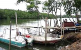
 Port Dickson is situated on the W coast of the Malaysian Peninsula facing the Strait of Malacca. The town stretches along the coast in the direction of Tanjung Tuan, located 8 miles SE.
Port Dickson is an important oil terminal operated by Shell and Esso, and is a minor port for general cargo.
Winds—Weather.—During the period from May through October, vessels may experience Sumatras, which usually blow from a SW to a NW direction. The average duration is between
1 hour and 4 hours, with wind velocities between 40 and 50 knots, followed shortly thereafter by heavy rain.
During the Southwest Monsoon, there is a continual swell and rough sea at the anchorage. At other times, an appreciable swell may also be experienced.
Tides—Currents.—Port Dickson tides are semi-diurnal. At the outer anchorage, the tidal current sets SE from 3 hours 30 minutes before until 2 hours 45 minutes after HW, and NW from 3 hours 25 minutes after until 4 hours 45 minutes before HW at Port Dickson.
In the inner anchorage, the tidal current sets SE from 3 hours 45 minutes before until 3 hours 45 minutes after HW, and NW during the remaining period.
The tidal current close inshore on the W side of Tanjong Kamuning at times sets in an opposite direction to that of the outer anchorage, resulting in a confused tidal condition and eddies in the fairway S of Tanjong Kamuning.
Depths—Limitations.—There is a deep water approach channel from NW, marked by lighted buoys, which presents no difficulties and is clear of dangers.
Port installations comprise the following:
1. Esso-Shell Single Buoy Mooring, a yellow steel buoy, 10.7m in diameter, in a least depth of 27.4m, with a sand, mud, rock, and stone bottom.
This facility will accommodate tankers up to 274m in length with a 14.3m draft or 90,000 dwt capacity.
2. The Railway Jetty, 182.9m long with a 46m face, is used by dry cargo vessels and LPG carriers drawing up to 7.9m. A small boat harbor that is contained in the curve of the stone approach to the Railway Jetty affords little shelter against S winds and dries out at LW.
3. Shell Jetty is situated about 0.1 mile W of the Railway Jetty. It is a 213m long reinforced concrete jetty with a 51.8m long and 10.9m wide T-head and four dolphins. The maximum distance between the outer dolphins is 304.8m.
Alongside depths of 7.9m allow vessels up to 18,000 dwt with a length of 152.4m and a draft of 6.4m to berth. Berthing maneuvers usually take place in daylight; vessels over 121.9m in length requiring to swing are taken in on the flood only.
4. New Shell Jetty is a 430m long T-head jetty with three berths. Berth 1 and Berth 3, on its seaward face, can accommodate a vessel with a maximum draft of 10.5m. Berth 2, on the SE landward face, can accommodate a vessel with a maximum draft of 7.5m.
5. Esso Jetty is situated about 0.5 mile NW of Shell Jetty.
It consists of a reinforced concrete island, 64m x 7.3m, with a distance between the outer buoys of 219.5m. The approach depth is 12.2m. There is an alongside depth of 10.3m, which allows vessels up to 19,500 dwt, with a maximum length of 170.7m, to berth day or night.
Berthing is during daylight only but can be carried out on any state of tide for vessels up to 45,000 dwt. Vessels above this limit are berthed on the ebb only. A submarine oil pipeline is laid to the buoy from the shore, about 0.1 mile N of Tanjong Kamuning. Two floating hoses marked by lights may extend up to 230m from the mooring buoy.
6. The head of a T-headed jetty extending about 1 mile WSW from the shore is situated about 1 mile N of the Esso-Shell SBM; a submarine pipeline connects the SBM and the pier.
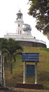
Aspect.—A large power station, with three conspicuous chimneys, one 118m high and the other two 94m high, stands on reclaimed land 0.7 mile N of Tanjong Kamuning. A conspicuous chimney, 94m high, with a flare, about 0.1 mile ENE and another flare 1 mile further E, stands 1.25 miles NE of Tanjong Kamuning.
Pilotage.—Compulsory for vessels berthing/unberthing at Railway Jetty and for berthing/unberthing at the SBM. Private services are operated by Shell and Esso for vessels making use of their respective facilities.
The mooring master boards 1 mile N of Fairway Lighted Buoy; vessels less than 30,000 dwt may be boarded at No. 1 Buoy.
The vessel’s ETA should be sent, via Penang or Singapore Radio, 96 hours and 24 hours in advance. Vessels should keep a listening watch on Shell Port Dixon Radio on VHF channel 16 beginning 2 hours before arrival.
Anchorage.—Temporary anchorage for large vessels may be obtained 1 mile N of Fairway Lighted Buoy, in a depth of 24m, or 1.25 miles WNW of No. 1 Lighted Buoy.
Small vessels may anchor NE of Palau Arang, in depths of 7 to 9m, but holding ground is poor. A prohibited anchorage area is shown on the chart extending 1 mile W from Tanjung Kamuning and S around Palau Arang to the Railway Jetty.
SHELL REFINING CO
Batu 1 , Jalan Pantai, 7100 Port Dickson,
Negeri Sembilan
Tel : 06-6471311
Fax : 06-6474622
ESSO STANDARD MALAYSIA
Batu 1 1/2, Jalan Pantai, 71000 Port Dickson,
Negeri Sembilan
Tel : 06-6471666
Fax : 06-6474717
")
Ebook | Strait of Malacca (East)
|
Ebook | Sumatra (Indonesia)
|