Tanjung Pertandangan (E Sumatra)
10nm
88°
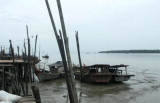
The mangrove covered coast is mostly muddy and low lying. The coastal bank, as far out as the 10m curve, is marked by fishing stakes and enclosures. Fishing ...
23 Jan 12
Jojo
| Latitude | Longitude | |
| DMS | --- | --- |
| DM | --- | --- |
| DD | --- | --- |


 The coast forming the W side of Kualu Geul, which leads to the Sungai Kualu, has no distinctive marks, except a customs station on piles close off the village of Simendulang, about 7 miles S of Tanjung Siapiapa and some houses on piles off Tanjung Sibabi, about 1.7 miles farther S.
The settlement at Ledung is difficult to make out by day, but at night the lights of the houses can be seen and distinguished from those on the fish stakes on the banks of the Sungai Ledung which lies S of the settlement.
A buoy is moored about 7 miles ESE of Tanjung Siapiapi.
There are four channels leading to the entrance of the Sungai Panai but Teluk Piai Geul, which has a depth of 2.4m is the only one now in regular use. It lies close W of the outer buoy and close E of the mudbank extending N from Tanjung Prapat, the W entrance point of the Sungai Panai.
The channel is buoyed on its W side.
Kualu Geul, the westernmost channel, passes W of the outer buoy and leads to the settlement at Ledung on the W side of the entrance to the Sungai Kualu, about 3 miles S of Tanjung Sibabi; this channel, which is not buoyed, has depths of 1.8 to 2.7m over the bar, about 1.2 miles E of the settlement. These channels are subject to change in depth and direction.
In the inner approaches to the Sungai Kualu and the Sungai Panai, there is a swept channel best seen on the chart. It is 198m wide and marked by buoys on its W end.
Tanjung Ledung, about 0.5 mile S of the S entrance of the Sungai Ledung, stands out distinctly. A customs station with a pier extending from it stands at Ledung. This pier has a depth of 0.6m in its approach. Between Tanjung Kluang, about 3 miles S of Tanjung Ledung and Tanjung Mengedar, about 9 miles farther up, there are depths of about 1.2m.
Ebook | Sumatra (Indonesia)
|