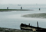
Sagar island (W Bengal-India)
15nm
147°
The main fairway leading into the Hugli River passes close off the SW extremity of this island. Although well-populated and heavily ...
28 Apr 12
Jojo
| Latitude | Longitude | |
| DMS | --- | --- |
| DM | --- | --- |
| DD | --- | --- |


 River (NE India)")
 River (NE India)")
 River (NE India)")
 India’s
Hugli River (sometimes spelled "Hooghly") is a Ganges River
distributary, one of the many branches of the river that are
collectively known as the "Mouths of the Ganges".
India’s
Hugli River (sometimes spelled "Hooghly") is a Ganges River
distributary, one of the many branches of the river that are
collectively known as the "Mouths of the Ganges".Vessels entering the Hugli River approach Eastern Channel Light Vessel, which is moored about 46.5 miles SSE of Sagar Island Light.
During the Southwest Monsoon, it is best to make the coast near Puri or between Pundi and Ganjam, where higher land backs the coast. When the weather is very hazy, the land is obscured until a very near approach is made. It is advisable to determine a vessel’s position before proceeding N of Puri.
Soundings provide a guide when approaching this coast; the 183m curve lies about 21 miles SE of Pundi, 23 miles SE of Ganjam, and 15 miles S of Puri. At night, vessels should make Kalingapatam Light, Gopalpur Light, or Puri Light. Depths of 36.6m lie about 4 miles off Kalingapatam, 3.5 miles off Ganjam, and 13 miles S of Puri; continuous soundings should be taken when approaching the coast.
At night or in bad weather, a vessel should proceed along the coast in depths of about 36.6m. During the day, in clear weather, the Jagannath Pagodas at Puri and the black pagoda at Konarak should be sighted when passing. When about 10 miles beyond the black pagoda at Konarak, course should be shaped for Eastern Channel Light Vessel. Care should be given to the soundings when passing False Point, as the depths decrease gradually toward the shoal ground around it. At night, vessels should keep in depths of not less than 26m or even 37m when the wind is SE.
In September, toward the end of the Southwest Monsoon, the current sets strongly to the SW, and if a vessel’s position is fixed, landfall should not be made so far to the S.
During the Northeast Monsoon, if a vessel is on the E side of the Bay of Bengal, course should be shaped directly for Eastern
Channel Light Vessel.
A bank, located in position 20°44'N, 87°35'E and extending off the coast between False Point and Palmyras Point, is an excellent guide when approaching the entrance of the Hugli River. The bottom, when in depths of 36.6 to 42.1m, consists of reddish-colored shell and sand and gravel; in deeper water to the E or seaward, the bottom consists of sand and mud with shining specks, or olive-colored mud with broken shells. The E edge of the ridge is rather steep, with depths seaward of it ranging from 51 to 55m.
The 35m curve follows the NE curve of the coast and lies about 24 miles E of False Point Light and 25 miles E of Palmyras Shoals.
Pilotage is compulsory N of latitude 21°39'N for all vessels of over 200 nrt. Pilots are available 24 hours.
A Vessel Traffic Management System (VTMS) is in operation to improve the safety of vessels entering Calcutta and Haldia.
Three radar surveillance stations located at Sagar Island, Frasergunj, and Haldia will allow vessels to enter the navigation channel safely on the Hugli Delta between Talent Wreck Light Vessel (21°17.0'N., 88°11.5'E.) and the pilot boarding ground. The VTMS guidance is provided by the Hugli River Pilots. The VTMS can be contacted on VHF channel 68, call sign “VTMS Control.”
When anchoring, vessels should stem the tide before letting go an anchor, because the current sets strongly at the Sandheads.
Navigation on the Hugli River is reported to be difficult.
The 39-mile stretch from Hugli Point to Calcutta is the most treacherous. In 1984, it was reported that the channel buoys were not well maintained, many were either unlit or missing. It was reported (1976) that night navigation above Hugli Point was prohibited.
The navigable channel in the river is subject to annual variations; these are caused by the scour of the freshets and the flood current, as the season is wet or dry, respectively. The channel through the estuary is subject to such changes as occur in all wide, sandy, tidal estuaries.
Vessels take advantage of the rise in tide and cross the shallowest bars at HW; this results in bunching of vessels. A vessel inbound can generally go up the river with the tide without any stops, but sometimes it might take about 24 hours with an anchorage stop along the way. An outbound vessel cannot cover the total distance of the river during the same high tide; the transit down the river is made in stages. According to the speed and type of vessel, sailing down the river takes about 36 to 48 hours, with stops at Ulubaria (abreast of Achipur Point), Diamond Harbor or Kulpi Roads, and Sagar Roads Anchorage.
Sharp bends in the river upstream of Diamond Harbor limit the length of a vessel to 189m at Buj-Buj and 172m at Calcutta.
During times of predicted tidal bores, the overall length of vessels will be regulated by the harbor master.
The navigable channels of the Hugli River, leading to Calcutta N of the parallel of latitude 21°01'N, are under the jurisdiction of the Port Commissioners of Calcutta.
Vessels proceeding against the current should slow down or stop if it appears that other vessels will be met with at difficult parts of the river, or on bars where the deep-water channels are narrow. The usual rule of the road is adhered to in the river and estuary. A prolonged blast of the whistle, quickly followed by three short blasts, is an optional signal that the vessel making the signal is obliged to stop and cannot get out of the way.
There are three distinct periods in the year, lasting approximately 4 months each.
During the cold season, the flood current has a slight preponderance over that of the ebb, because of its shorter period of flow.
The flood current, during the second half of the dry season, is made considerably stronger than the ebb by the Southwest Monsoon. During the rainy season, the flood current is overpowered by the descent of freshets and the ebb current predominates accordingly.
The great body of the tidal current flows in the direction of the channels at velocities of 2 to 3 knots at springs and 1 knot to 1.5 knots at neaps.
At LW during spring tides, the flow of the flood current is checked by the shallow and restricted bed of the river and by the seaward flow of water from the upper reaches. These conditions can lead to the creation of a tidal bore.
Bores in the Hugli River occur only with a greater than average spring tide, and usually when the seaward flow is augmented by freshets. Extreme tidal bores are most prevalent in March and September and reach heights of 2.4 to 6.1m.
During the Northeast Monsoon, from November to February, freshets do not occur and for this reason, bores are a rarity.
When they do occur during this particular season, it is likely to be at night. They are dangerous because they are unexpected. It is advisable to anticipate their occurrence during this season whenever greater than average spring tides are predicted.
With the Southwest Monsoon, the occurrence of freshets during greater than average spring tides will always cause bores, those preceding the daylight HW being higher than those at night.
The first appearance of the bore is on Diamond Sand), on the W side of the river abreast Diamond Harbor, where the ascending wave runs on as a breaking roller. It is not of much consequence until it enters the contracted reaches above Hugli Point, when, besides swamping boats, it affects vessels at anchor by causing them to run upstream, especially if there is a strong S breeze. The bore reaches a maximum at Chinsura, about 26 miles above Kidderpore Docks, and disappears about 14 miles farther up the river above Naya Serai.
Vessels at moorings surge and roll during the passage of the bore as there is a sudden lift of 1.2 to 1.8m; when bores are expected, springs must be put on the flood moorings close down to the buoys to relieve the jerk on the cable and bits. Vessels at anchor have been known to break their anchor chains during extreme tidal bores.
Bars, bends, and bores, known as the three Bs, constitute the main dangers to shipping in the Hugli River. Numerous bars, with continuous fluctuating depths over them, encumber the winding channel of the river.
The river is high from June to October and during this period, vessels drawing up to 8.5m can reach Calcutta at HWS.
Vessels drawing up to 7.9m can reach the port at HWN. From October to June, the river is low and the maximum permissible draft is 7.3m. Maximum drafts may vary from year to year according to the season, but vessels drawing up to 8.8m have ascended the river to Calcutta; special arrangements have to be made and the date selected by the Port Pilotage Office.
Vessels proceeding to Calcutta should arrive at the pilot station with drafts as close to an even keel as possible.
In some parts of the river, the changes in depths and the directions of the channels are very rapid and no attempt will be made to describe them or the navigational aids which mark them.
Although the charts may currently be correct, they can not be relied on to give an accurate presentation of the depths and dangers which may be encountered because of these rapid changes.
Signal stations are situated near the lighthouse on Sagar Island, on the E bank at Diamond Harbor, and at Hugli Point, about 6 miles above Diamond Harbor. Diamond Harbor Signal Station is connected by telegraph, and the other stations are connected by telephone with Calcutta.
Tides in the Hugli River are semi-diurnal.
Tidal semaphores have been established at the following places to indicate the rise of the tide in the Hugli River:
1. About 0.5 mile SSW of Sagar Island Light. Tidal information is also broadcast on VHF channel 16.
2.
At Gangra, on the W bank about 7.5 miles NW of the N point of Sagar
Island. Tidal information is also broadcast on VHF channel 16.
3. At Balari, on the W bank about 12 miles NE of the tidal semaphore at Gangra.
4. On Hugli Point, about 12 miles upriver from the semaphore at Balari. Tidal information is also broadcast on VHF channel 13.
5. At Moyapur, about 17 miles downriver from Kidderpore Docks. Tidal information is also broadcast on VHF channel 13.
6. At Akra, about 6.5 miles downriver from Kidderpore Docks. Tidal information is also broadcast on VHF channel 13.
7. At Rajabagan, about 3 miles downriver from Kidderpore Docks.
At the moment of HW, a ball is hoisted to its upper position; as the tide begins to fall, the ball is lowered to the lower position until the tide has fallen by 1m, when the ball is hauled down. At LW, the ball is hoisted to the lower position; as the tide begins to rise, the ball is hoisted to the upper until the tide has risen by 1m, when the ball is hauled down.
Night semaphores are situated at Sagar, Gangra, Balari, Hugli Point, and Moyapur.
Each semaphore can display two flashing lights, an upper light showing a 2-second flash every 8 seconds and a lower light showing one flash every second.
Ebook | Bay of Bengal
|