Haldia port (W Bengal-NE India)

Haldia port (W Bengal-NE India)

Per individuare con precisione. Aggiornare se necessario.

Localizzazione

Haldia port (W Bengal-NE India)
LatitudeLongitude
DMS------
DM------
DD------

Caratteristica

Porto
VHF Channel 16
Porto commerciale

Descrizione

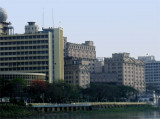
Haldia is a city and a major seaport and industrial belt located approximately 50 kilometres southwest of Calcutta near the mouth of the Hooghly River, one of the distributaries of the Ganges. It is in the Indian state of West Bengal.

Haldia is being developed as a major trade port for Calcutta (Kolkata), intended mainly for bulk cargoes.

The port can be contacted, as follows:
1. VHF: VHF channel 16
2. Telephone: 91-3224-252104
3. Facsimile: 91-3224-252251
4. E-mail: haldia@hub.nic.in

Anchorage can be taken in mid-channel, in a depth of 11m, abreast of the port area over a bottom of medium to hard mud and sand, good holding ground.

The maximum rate of the current in the river is about 5 knots, both on the flood and the ebb.

2012/04/30
Aggiornare
Jojo
Haldia port (W Bengal-NE India)
2012-04-30
Aggiornare
Jojo
Md najim
2017/09/13
Aggiornare
Haldia port (W Bengal-NE India)
robiul
2018-08-29
Aggiornare
Anonymous
Haldia port (W Bengal-NE India)
2018-08-29
Aggiornare
Anonymous
Haldia port (W Bengal-NE India)
bdiut
2018-08-29
Aggiornare
Anonymous
Ebook

Bay of Bengal

  • 110 sites
  • 82 photos
  • publication date: 7 Jul 2023
  • .pdf file size: 53 Mb
Condividi i tuoi commenti o le foto su "Haldia port (W Bengal-NE India)"

Siti intorno a Haldia port (W Bengal-NE India)

Flying distances - Direct line

Sagar road (Hugli river-India)

22nm
189°
Sagar Roads, the navigable entrance at the mouth of the Hugli River, lies about 2 miles W of the SW extremity of Sagar Island.

The navigable entrance channel leading to Sagar Roads is subject to change in position and direction to accompany the change in depths, which occur ...
28 Apr 12
Jojo

Hugli River Entrance (W Bengal-India)

22nm
201°
Eastern Channel Light Vessel, which is frequently moved, marks the entrance of Eastern Channel, the main fairway leading to the Hugli River. Eastern Channel is available for use both by day and night and leads into Gaspar Channel, which in turn leads into Sagar Roads.

Caution ...
28 Apr 12
Jojo

Calcutta port (W Nengal-NE India)

35nm
23°
The Port of Calcutta (Kolkata) is a riverine port in the city of Kolkata, India. It is the oldest operating port in India, having originally been constructed by the British East India Company.The port of Calcutta extends from Budge Budge, about 21 miles above Hugli Point, to Konnagar, ...
30 Apr 12
Jojo

Subarnareka River (N Orissa-NE India)

47nm
233°
Subarnarekha River (also called Swarnarekha River) flows through the Indian states of Jharkhand, West Bengal and Orissa.
As per tradition, gold was mined near the origin of the river at a village named Piska near Ranchi. This is why it was named Subarnarekha, meaning ‘streak ...
26 Apr 12
Jojo

Panchpara River (N Orissa-NE India)

61nm
239°
The Panchpara River discharges into the sea about 4.5 miles NE of the entrance of the Burhabalang River. The river is navigable only by small native craft capable of crossing the bar.
26 Apr 12
Jojo

Baleshwar (or Balasore) (N Orissa-NE India)

68nm
241°
Baleshwar lies on the S bank of the Burhabalang River, about 16 miles above its mouth. This town was formerly a port of some importance, but in recent years there has been no seaborne trade.

Cargo is transported by barges from the anchorage in Baleshwar Road.
It is best ...
26 Apr 12
Jojo