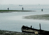

Haldia port (W Bengal-NE India)
35nm
203°
Haldia is being developed as a major trade ...
30 Apr 12
Jojo
| Latitude | Longitude | |
| DMS | --- | --- |
| DM | --- | --- |
| DD | --- | --- |

 channel 16


 The Port of Calcutta (Kolkata) is a riverine port in the city of Kolkata, India. It is the oldest operating port in India, having originally been constructed by the British East India Company.
The port of Calcutta extends from Budge Budge, about 21 miles above Hugli Point, to Konnagar, about 21 miles farther upriver, the limits being marked by boundary pillars.
The port is about 83 miles above the entrance of the Hugli River, and about 128 miles from Eastern Channel Light Vessel, near The Sandheads.
The Howrah Bridge, about 15 miles above the downriver boundary of the port, crosses the river above Howrah Railway
Terminus and is a steel cantilever structure, with tower on either side of the river which rises to a height of 91m. Several ferries ply across the river. The bridge marks the upper limit of navigation for ocean-going vessels.
Modern well-equipped berthing facilities are provided for all classes of vessels alongside and at the mooring buoys in the river.
Calcutta, the second largest commercial port in India, is also the site of the largest city.
Tides in the Hugli River at Calcutta are semidiurnal.
When regular, the flood runs 5 hours and the ebb runs 7 hours. During the Northeast Monsoon, the velocity of the current is 3 to 3.5 knots at springs and 1.5 to 2 knots at neaps. Between March and July, the velocity of the flood is increased and reaches a maximum velocity of 4 to 7 knots at springs.
During the freshets, July to October, the flood is weak and of short duration and at neaps may be nearly imperceptible; the ebb during freshets has a maximum velocity of 7 knots at springs. Anchors are then quickly buried by the silt, so that sometimes it is necessary to slip the cable and leave the anchor to be picked up by the Port Commissioners. The tidal currents set fair up and down Calcutta Reach.
Mooring berths in the river have sufficient depths to accommodate any vessel that can enter the river. Depths at the moorings range from 5.5 to 15.2m, but vary according to their location in the river.
Kidderpore Docks comprise No. 1 Dock, No. 2 Docks, and a turning basin. The lock entrance from the river is 176.8m long and 24.4m wide. Vessels up to a maximum length of 157m and a beam of 21.3m can enter Kidderpore Docks. No. 1 Dock has
11 berths; No. 2 Dock has eight berths for general cargo and six coal berths. A depth of 9.1m exists alongside the berths in both docks.
Nataji Subhas Docks (King George Dock) lock entrance is 213.4m long and 27.4m wide. Vessels up to 172m may enter the dock. Seven berths, with a depth of 10m alongside, are available for ocean-going vessels. The other berthing facilities within the dock are for the sole use of lighters. In 1985, there were two container berths and cranes in Nataji Subhas Docks.
Garden Reach Jetties consist of five jetties for ocean-going vessels. Vessels, with lengths from 137 to 172m can be accommodated alongside.
Vessels berthed at Garden Reach Jetties are limited to a draft of 5.5m during bore periods.
Calcutta Jetties, which lie below Howrah Bridge, consist of nine jetties, but only five are available to ocean-going vessels.
The petroleum facilities at Buj-Buj (Budge Budge) consist of eight pontoon jetties. Vessels, with a maximum draft of 9.1m, can be accommodated alongside these berths.
Vessels mooring in the river are required to moor head stern, with two lower and stern cables shackled to the permanent moorings which are laid parallel with the banks.
Port Regulations are supplied to vessels on arrival by the harbor master.
Rules regulating the handling of explosives are issued by the port authorities. Masters of vessels with explosives on board are required to give an advance notice of arrival of 72 hours.
The port can be contacted, as follows:
1. VHF: VHF channel 16
2. Telephone: 91-33-22303451
3. Facsimile: 91-33-22204901
4. E-mail: portofcalcutta@portofcalcutta.com
") Calcutta waterfront
Calcutta waterfront") Calcutta quay
Calcutta quayEbook | Bay of Bengal
|