Baleshwar lies on the S bank of the Burhabalang River, about 16 miles above its mouth. This town was formerly a port of some importance, but in recent years there has been no seaborne trade.
Cargo is transported by barges from the anchorage in Baleshwar Road.
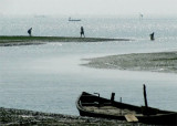
It is best known for Chandipur beach. It is also the site of the Indian Ballistic Missile Defense Program's Integrated Test Range, located 18 km. south of Balasore. The Defence Research and Development Organisation developed many different missiles such as Nag, Brahmos, Agni missile among others here.
The Panchpara River discharges into the sea about 4.5 miles NE of the entrance of the Burhabalang River. The river is navigable only by small native craft capable of crossing the bar.
Kanika Sand, an extensive drying mud and sand flat, lies on the N side of the entrance channel about 0.8 to 5.5 miles W of Shortt Island. This flat has been reported extending to the SE.
The outer bar, which has a least depth of 1.5m, lies about 1.3 miles NNW of the middle ...
Subarnarekha River (also called Swarnarekha River) flows through the Indian states of Jharkhand, West Bengal and Orissa. As per tradition, gold was mined near the origin of the river at a village named Piska near Ranchi. This is why it was named Subarnarekha, meaning ‘streak ...
Balisahi Point is the extremity of the low land N of the entrance of the Dhamra River.
The coast between Balisahi Point and the entrance of the Hugli River, about 69 miles NE, is low, flat, and covered with scrub and mangroves along its S part. Southwest of Chandipur, the trees ...
Palmyras Point, about 6 miles W of Shortt Island, is the N extremity of the low land which lies between the Maipura River and the Dhamra River. The point is difficult to distinguish because of the dense jungle growth which covers it. The low land on the N side of the Dhamra River ...
Shortt Island, 3 m high, is the largest of four small islands which lie on a drying shoal about 3 miles N of Maipura Point. The configuration of the island is constantly changing due to the continuous action of the sea. A tower, 17.3m high, stands close off the E side of the island.


 Baleshwar lies on the S bank of the Burhabalang River, about 16 miles above its mouth. This town was formerly a port of some importance, but in recent years there has been no seaborne trade.