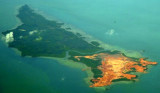
Teluk Bintan (Bintan Bay) indents the coast to the E of Pulau Ujan, into which several small rivers discharge. Kapal and Ketir are two low, wooded islets lying on a bank that dries on the E side of the entrance to the bay.
The Merodong group of islands lie to the W of Pulau Mesanak, between it and the Temiang group. The former group comprises six islands, separated by channels unsuitable for navigation and there is no reason in venturing among them or between them and Pulau Mesanak. Merodong, the ...
Pulau Karas Br, lying about 4 miles N of Korek Rapat, is 3.5 miles long and about 0.7 mile wide; it is hilly, with a flat summit, wooded, and has a reef encircling it extending in places for a distance of 0.25 mile.Pulau Karas-Ketjil (Karas-Kecil), an island marking the SW end of ...
The Selanga Islets, three in number, lying on the SE of Selat Pengelap, are small but elevated and conspicuous; the S islet is 35m high. With an opposing wind and current, a troublesome sea may arise in this area.The Pangelap group of islands separates Selat Pangelap from Selat Abang. ...
Pulau Telan (Telang), the SW point of which forms the SE limit of Selat Riau, is irregularly shaped and nearly 5 miles long, NE and SW, and about 1 mile wide. It is divided into two parts and may be identified by a square hillock on its S end, 63m high, which, with a sharper peak ...
Pulau Pelanduk Subang Mas lies about 2 miles NW of Pulau Cemara.Pulau Airradja (Airaja), lies close N and is separated by a narrow drying channel at LW. It is the northernmost of the islands lying between Pulau Cemara and the E entrance of Selat Bulan.Both these islands are hilly ...
Pulau Dompak, 4 miles long and about 2 miles wide, is separated from the W coast of Pulau Bintan by Selat Dompak (Dompak Strait), a narrow channel only available to boats.The land in the vicinity of the channel is quite hilly and surrounded with tall trees, as opposed to low land ...


 Teluk Bintan (Bintan Bay) indents the coast to the E of Pulau Ujan, into which several small rivers discharge. Kapal and Ketir are two low, wooded islets lying on a bank that dries on the E side of the entrance to the bay.