Selanga Islets and Alor Islands (Indonesia)

Selanga Islets and Alor Islands (Indonesia)

Pour géolocaliser ce lieu. Mettre à jour si besoin.

Localisation

Selanga Islets and Alor Islands (Indonesia)
LatitudeLongitude
DMS------
DM------
DD------

Caractéristiques

Île / Atoll

Description

The Selanga Islets, three in number, lying on the SE of Selat Pengelap, are small but elevated and conspicuous; the S islet is 35m high. With an opposing wind and current, a troublesome sea may arise in this area.

The Pangelap group of islands separates Selat Pangelap from Selat Abang.

The Alor Islands, the southernmost of the Pengelap group, consist of some rocky islets lying on a reef; the southernmost islet is 46m high.

Pengelap, the largest of the group, is about 3.3 miles long, N and S, 0.5 mile wide, wooded, and moderately elevated, attaining a height of 80m in the N part; the island is fringed by a reef, which projects in places on the E coast to a distance of 0.25 mile, but on the W coast to a less distance.

Udiep (Oediep)
, an islet 39m high, thickly wooded, and surrounded by a reef, lies about 1.3 miles E of the N end of Pengelap, and in the channel of Selat Dempo.

Dedap, about 2 miles long, NW and SE, and about 0.3 mile wide, lies about 1 mile W of Pengelap.

2012/02/29
Mettre à jour
Jojo
Ebook

Sumatra (Indonesia)

  • 326 sites
  • 109 photos
  • publication date: 6 Jul 2023
  • .pdf file size: 100 Mb
Partagez vos remarques ou photos sur "Selanga Islets and Alor Islands (Indonesia)"

Sites autour de Selanga Islets and Alor Islands (Indonesia)

Flying distances - Direct line

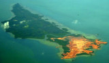
Merodong group (Indonesia)

12nm
125°
The Merodong group of islands lie to the W of Pulau Mesanak, between it and the Temiang group. The former group comprises six islands, separated by channels unsuitable for navigation and there is no reason in venturing among them or between them and Pulau Mesanak.
Merodong, the ...
10 Feb 12
Jojo

Pulau Mesanak (Indonesia)

16nm
111°
Pulau Mesanak, located 7 miles N of the N end of Pulau Sebangka, has the form of an elbow, of which the long arm extends 4.5 miles in a N and S direction, and the short arm 3 miles E and W. Ridges of hills extend the whole length of both arms, the highest point, 107m high, being where ...
11 Feb 12
Jojo

Pulau Cempah - Pulau Laut (Indonesia)

21nm
174°
Pulau Cempah (Tjempah) is irregularly shaped, hilly and about 5 miles long and 2 miles wide. It is separated from the NW part of Pulau Bakung and Blandok Besar and Karoti by Selat Cempah (Tjempah Strait, 2 miles wide, which has general depths of about 24m.
Pulau Cempah is fairly ...
27 Feb 12
Jojo

Pulau Karas Besar and Karas Kecil (Indonesia)

14nm
13°
Pulau Karas Br, lying about 4 miles N of Korek Rapat, is 3.5 miles long and about 0.7 mile wide; it is hilly, with a flat summit, wooded, and has a reef encircling it extending in places for a distance of 0.25 mile.Pulau Karas-Ketjil (Karas-Kecil), an island marking the SW end of ...
14 Feb 12
Jojo

Pulau Sikeling - Blanding - Lobam (Indonesia)

21nm
191°
Pulau Sikeling, 91m high and about 1 mile long, lies 1 mile S of Pulau Buaya.
Blanding lies about 1 mile NW of Pulau Sikeling; it is the S of three islands located on a reef that extends about 4 miles NW.
Lobam, 84m high, lies on the N part of this reef. Turka lies between Blanding ...
27 Feb 12
Jojo

Pulau Telan (Indonesia)

24nm
56°
Pulau Telan (Telang), the SW point of which forms the SE limit of Selat Riau, is irregularly shaped and nearly 5 miles long, NE and SW, and about 1 mile wide.
It is divided into two parts and may be identified by a square hillock on its S end, 63m high, which, with a sharper peak ...
26 Feb 12
Jojo