Moen Lighthouse With a growing traffic in the middle of the 1800s increased the need for demarcation of the Danish coasts. In 1845 the lighthouse was the maid garnish turned south and followed a few years after the lighthouse on Dasser Ort in Mecklenburg coast. The 13 meter high ...
Gedser Lighthouse Started in 1802 as a tower with closed coal lighthouse which in 1834 changed to mirror apparatus. Tower increased in 1851 and fitted with fixed lens apparatus. In 1905 the tower was elevated again and the lens unit was exchanged for a rotary, bear glødenetsbrænder ...
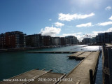
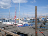
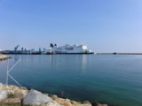
Le port de Lomma est situé sur l'Oresund, coté Suèdois dans la région de la Scanie. Il offre une capacité de 200 places environ. Entrance of the harbor The harbor


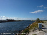
 Petit port protégé par une digue.
 Small port protected by a breakwater.