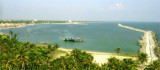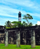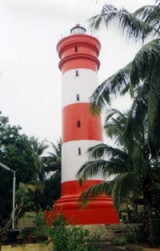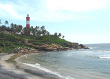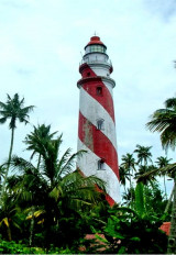

Tangasseri Point (W India)
3.6nm
154°
The coast from close E of Tangasseri Point to about 3 miles NNW of it is rocky with groves ...
18 Mar 12
Jojo
| Latitude | Longitude | |
| DMS | --- | --- |
| DM | --- | --- |
| DD | --- | --- |

 channel 16
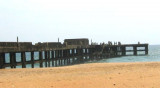
 Nindakara (Neendakara) is an open roadstead port at the entrance to Ashtamudi Backwaters.
The entrance can be identified from seaward by a break in the palms fringing the shore, and by a bridge, which is prominent, spanning the outlet.
The port is seasonal, operating from mid-November to mid-April.Pilotage is not available.
Storm signals are displayed; the Brief System is used.
The port can be contacted from 0800 to 2200, only when a vessel is loading, as follows:
VHF: VHF channel 16
Tel: +91 471 2324842
Fax:+91 471 2324533
Mail: portsdir@asianet.in
")
Ebook | Arabian Sea
|