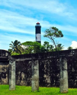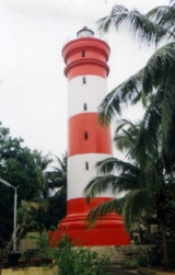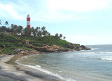

Tangasseri Point (W India)
0.6nm
273°
The coast from close E of Tangasseri Point to about 3 miles NNW of it is rocky with groves ...
18 Mar 12
Jojo
| Latitude | Longitude | |
| DMS | --- | --- |
| DM | --- | --- |
| DD | --- | --- |

 channel 16
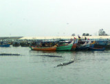
 The port of Quilon (Kollam) is a small roadstead lying in the bight close SE of Tangasseri Point. The N and S limits of the port are defined by lines extending in a 247° direction from two boundary pillars. The N pillar and the S pillar lie about 0.7 mile E and 3 miles ESE, respectively, of Tangasseri Point.
Tangasseri Reef, consisting of foul ground and shoal water, extends about 1.5 miles W and 1 mile SW of Tangasseri Point. Pallikall Shoal, with a depth of 2m, lies about 0.7 mile ESE of Tangasseri Point, near the SE end of the coastal reef. A black buoy and a red conical buoy are moored about 1 mile and 1.3 miles SE, respectively, of Tangasseri Point.
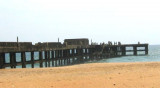
The port is protected by the Tangasseri Breakwater, extending about 1.1 miles SSE of Tangasseri Point. The breakwater was completely restored and strengthened in 2009 after tsunami damage that had occurred 5 years previous and now has a permanent road laid along the entire length. There is also a lee breakwater extending about 500m SSW of the old Post Office with a wharf, 116m in length, located at the W end of this breakwater.
There is a least depth of 8.9m in the fairway of the channel between the buoys and a depth of 8.6m about 0.2 mile SSE of the black buoy. The red conical buoy marks the NW end of a group of dangers, with a least depth of 6.4m, extending ESE.
The basin presently accommodates vessels up to a draft of 7m but there are plans (2009) to increase this to 10m.
Gamaria Rock, with a depth of 7m and marked close N by a black and white conical buoy, lies about 1.3 miles ESE of Tangasseri Point. The above buoys are in position from October to May. There is heavy surf along the steep beach fronting the bight and landing is dangerous except in native boats.
Tel: 91-474-743825
Fax: 91-474-743825
Mail: portkollam@yahoo.co.in
Anchorage off Quilon (Kollam) is exposed to winds from the NW through W to SE, and is little frequented during the Southwest Monsoon, when communication with the shore is only practicable by signal. During the Southwest Monsoon vessels should anchor, in not less than 15m, with Tangasseri Point bearing about 000°, distant over 1 mile.
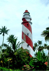
Between October and May, vessels can anchor in the inner anchorage, between Gamaria Rock and Pallikall Shoal, in about 9.1m, sand, with the red chimney of the tile works bearing 040°, and Tangasseri Light bearing 299°. A large vessel may find a position about 0.3 mile farther SW more comfortable.
 Port (W india)")
Ebook | Arabian Sea
|