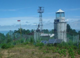
Pulau Burung (Burung-E Sumatra)
Kateman Island and Pulau Burung are ...
| Latitude | Longitude | |
| DMS | --- | --- |
| DM | --- | --- |
| DD | --- | --- |
 Teluk Kualacenaku is about 20 miles wide between Tanjung Bakau and Tanjung Dato, a low headland, and about 17 miles long to the mouth of the several rivers of which it is the estuary. The coast is everywhere low and marshy, and the greater portion of the bay is very shallow.
The outer edges of the mud banks extending from the entrance points of the bay are steep-to, having depths of 18.3 to 20.1m within 0.5 mile of the 5m curve in places; these mud banks should be given a wide berth. Fishing enclosures may be seen on the shallow banks in various parts of the bay.
Outside Teluk Kualacenaku, the flood current sets to the S and ebb to the N.
In the bay, to about 4 miles from the shore, the flood sets to the W, S of Tanjung Dato, and continues from S to SW between Pulau Busung (Boesoeng) and Pulau Jawang (Tjawang) into Batang Toeaka, but S of Pulau Busung this current sets SW into Batang Terboeng.
The flood also sets SW, or on to the NE edge of the 5m curve, 9 miles S of Tanjung Dato. The ebb from abreast Pulau Busung sets to the N and then continues to the E along the coast to the S of Tanjung Dato. In the middle of the bay, the ebb sets to the E. The greatest rate of the tidal current observed was 3 knots.
Ebook | Sumatra (Indonesia)
|


