Rob Roy Bank, a ridge about 15 miles long in a NW to SE direction with a least depth of 2.1m, lies about 27 miles SE of Tanjung Medang. A patch with a depth of 2.4m lies about 1.5 E of the 2.1m depth. The bank is steep-to on its NE and SW sides. A lighted beacon, exhibiting a racon, stands in the middle of the bank. A wreck, the exact depth which is unknown but which is considered to have a safe clearance of 15m and whose charted position is only approximate, lies about 11 miles E of Rob Roy Bank. Another wreck, with a depth of 17m, was reported to lie 1.5 miles farther SE. Another dangerous wreck lies in an approximate position about 10 miles NE of the bank.
Between Melaka and Tanjong Seginting, about 46 miles SE, the low, thickly wooded coast is bordered by a mud bank which extends up to 2.5 miles offshore in places. The Water Islands, centered about 8 miles SE of Melaka, consists of a group of six tree-covered islands of moderate ...
Vowler Bank, with depths of less than 20m, lies with its NW end about 5 miles SE of the 2.4m depth on Rob Roy Bank. A 9.1m patch lies near the NW end of the bank and a similar depth lies s about 3 miles SE.
Pyramid Shoal, which lies on the N side of the SE end of South Sands, has a least depth of 3.4m, hard sand, and is the most dangerous shoal in the area because of its depth and protrusion into the fairway. A lighted buoy is moored about 7 miles SE of Pyramid Shoal. A depth of about ...
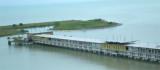
Malacca island or Pulau Melaka is a man-made island in Malacca town. it's linking to the mainland by a 30 m bridge on a side and has a jetty on the other side.
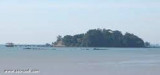
Pulau Upeh (formely known as "Liha Das Pedras", meaning place of stones), a conspicuous, densely-wooded islet, about 34m high to the tops of the trees, stands offshore about 3 miles W of St. Paul’s Hill. Pulau Upeh is a great
weekend retreat in Melaka with its first class ...
Pulau Batu Besar, 4.6m high, stands 1.25 miles offshore, 7 miles SE of Batu Tengah. A sandy ridge, with depths of 6.1 to 9.7m, lies from 0.5 to 2 miles NW of the rock. A shoal with a depth of 16.3m, lies 3.5 miles WSW of Pulau Batu Besar. Two white towers, each about 34m high, ...


 Rob Roy Bank, a ridge about 15 miles long in a NW to SE direction with a least depth of 2.1m, lies about 27 miles SE of Tanjung Medang. A patch with a depth of 2.4m lies about 1.5 E of the 2.1m depth. The bank is steep-to on its NE and SW sides.