
Limski Kanal
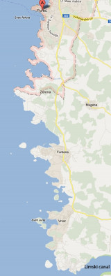
The Lim bay and valley is a peculiar geographic feature found near Rovinj and Vrsar on the western coast of Istria, south of Porec, Croatia.The Lim valley is the 35 km long valley ...
| Latitude | Longitude | |
| DMS | --- | --- |
| DM | --- | --- |
| DD | --- | --- |

 bonne tenue


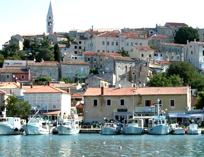
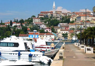
 The marina is settled on a small hill and is a picturesque village with the campanile placed at the top. It is only partially sheltered from the NW.
From the N, attention to the many rocks and shoals along the coast, particularly between Porec and Vrsar. Plic Velika, the danger off the most, is indicated at N by a buoy without fire. From Plic Velika, sail on O. Galina. HRID Orlandini is a small rocky island about 0.3 NM NW of O. Galina.
Access to the port of Vrsar passing between O. Galini and O. Sv Juraj, the island to the west of the port. Beware of the shoal that extends along the coast of NW O. Sv Juraj. Do not pass between O. Sv Juraj and the SE coast, the passage is blocked by rocks and a bridge. The marina is located on the N side of the harbor.
Tél: (+385) 052 44 10 52
Fax: (+385) 052 44 10 62
Mail: marina.vrsar@email.hinet.hr
220 B. (40 m)
Depth: 4 à 15 m
Ebook | Istrie (Istra)
|
 La marina est située en bas d'une petite colline, devant un pittoresque petit village avec un clocher au sommet. Elle n'est que partiellement abritée du NW.
En approchant par le S, attention aux hauts-fonds situés devant l'entrée du Limski Kanal, notamment à Plic Lim et Plic Kuvrsada (tous deux portent des bouées sans feu). Plus au N, une roche et des hauts-fonds sur la côte W de O. Lunga sont signalés par une balise cardinale W sans feu. Passer à mi-distance de cette balise et du feu de Plic Mramori et faire ensuite route sur O. Galiner.
En venant par le N, attention aux nombreuses roches et hauts-fonds qui bordent la côte, plus particulièrement entre Porec et Vrsar. Plic Velika, le danger le plus au large, est indiqué au N par une bouée sans feu. A partir de Plic Velika, faire route sur O. Galiner. Hrid Orlandin est un petit îlot rocheux à environ 0,3 NM au NW de O. Galiner.
On accède au port de Vrsar en passant entre O. Galiner et O. Sv Juraj, l'île à l'W du port. Attention au haut-fond qui s'étend sur la côte NW d'O. Sv Juraj. Ne pas passer entre O. Sv Juraj et la côte au SE, le passage est obstrué par des rochers et un pont. La marina se trouve sur la rive N du port.
Tél: (+385) 052 44 10 52
Fax: (+385) 052 44 10 62
Mail: marina.vrsar@email.hinet.hr
220 pl. (40 m)
Profondeurs: 4 à 15 m


