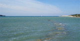
N of luka Crvar this small bay has a dock used by fishermen and boat moorings for fishing boats. You can anchor at the entrance to U. Sv marina by 16 m deep.
2011/03/22
Update
Joëlle
Au N de luka Crvar cette petite baie possède un quai utilisé par les pêcheurs et des mouillages pour les bateaux de pêche. On peut mouiller à l'entrée de U. Sv marina par 16 m de fond.
Koperski Zaliv (Baia di Capodistria) is entered between Rt Ronco and Rt Debeli, 5 miles NE.The NE and SW shores of the bay are hilly, but the shore at the head of the bay, through which the Fiume Risano flows, is low. Monte Sermino, surrounded by salt beds, rises isolated in the river ...
The Gulf of Piran or Piran Bay (Slovene: Piranski zaliv, Croatian: Piranski zaljev or Savudrijska vala, Italian: Baia di Pirano) is located in the northern part of the Adriatic Sea, and is a part of the Gulf of Trieste. It is between Rt Madona at N and Rt Saudrija. It was named ...
Warning: From Porec to the entrance to the Limski kanal there are a large number of dangerous shoals and rocks. On the N side of Funtana bay is the Janjci shoal, its northern edge is marked by a black post with two red bands and topped with two black spheres. At the southern ...
Limski Kana is entered between Rt Kriz, located 2.4 miles NW of Rovinj, and Rt Sjole, 1 mile NNW. The Lim bay and valley is a peculiar geographic feature found near Rovinj and Vrsar on the western coast of Istria, south of Porec, Croatia.The Lim valley is the 35 km long valley ...
From Rt Kriz (located S of Limski Kanal entrance), there are some shoals and islets. In front of Rt Muca are Figarola islet and Hr Figarolica at SW from it. Plic Muca, under 7/8 m of water, and Plic Skver, under 10 m of water, are off Rt Muca, NW of Uvala Valdenora, between Rt Muca ...
This large bay, located SW of Novigrad, between Cape Point and Meja Zub wearing a headlamp. Attention, from the N at high-tide "Plicina Val" marked by a buoy unlit face in Novigrad.


 N of luka Crvar this small bay has a dock used by fishermen and boat moorings for fishing boats. You can anchor at the entrance to U. Sv marina by 16 m deep.
 Au N de luka Crvar cette petite baie possède un quai utilisé par les pêcheurs et des mouillages pour les bateaux de pêche. On peut mouiller à l'entrée de U. Sv marina par 16 m de fond.