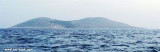
It is the the southernmost bay of Kornat, exposed to jugo; sheltered from bora.
Shallows: 180 m S
from the W cape of the bay (2 m). Warning: the best enter in the bay is from the SE; (in NE part of the
bay) the reef on the middle of the branch (about 100 m from the bottom
of the bay).
Berth: (smaller vessels) in NE
part of the bay (depth 4 m); along the stone jetty (shallow: depth
around 1.5 m). Mooring: (bigger vessels) on the entrance to the bay (depth
around 25 m); on the middle of the bay (two buoys); along the stone jetty (around 1.5 m).
2011/07/16
Update
Jojo
C'est la baie la plus au S de Kornat.
Attention aux hauts-fonds sous 2,10 m et 2,7 m au SW de la baie.
On peut mouiller au fond de la baie, par 15 m d'eau, sur les corps-morts qui ont été installés ou en portant une amarre aux bollards à terre. On peut ancrer au NE de la baie par 4 m ou s'amarrer le long de la jetée de pierre par 1,5 m. Les grands bateaux peuvent mouiller à l'entrée de la baie par environ 25 m. Au milieu de la baie on trouve deux bouées.
Otok Zirje
is the farthest and the largest island in the Sibenik archipelago. It is long of 6,5 NM (NW/SE) and 1,4 NM wide. The main village, Zirje, is located in the middle of the island. A small port, luka Muna, on the coast N of Zirje, home to the ferry that connects the ...
Vrgadski Kanal, 7 miles long, leads between Otok Murter and Otok Vrgada and is the principal channel used in the S approach to Pasmanski Kanal and Zadar. Vessels with a maximum draft of 6.4m may pass through Pasmanski Kanal. Vessels with drafts over 6.4m must either proceed through ...
Novigradsko More, a landlocked bay, lies at the S end of Novsko Zdrilo and provides good anchorage. Rijeka Zrmanja flows into the bay at the E side. This river is navigable by small craft as far as the village of Obrovca, 6 miles above the mouth. Luka Novigrad, a narrow inlet, ...
Kaprije is located in the central part of the Sibenik archipelago between the islands Zmajan and Kakan. The highlight of the island is Vela Glavica (132 m). The only village of the island is Kaprije, S. The port is busy. Automobiles are not allowed on the island.
O. Vela Smokvica and Mala Smokvica island are located S of O. Kornat, SW of Rt Opat. O. Vela Smokvica, uninhabited, has an area of 1.04 sq km and its length is 6.17 km of coastline. The highest peak (Veli) is 95 m high.The island has a lighthouse at the N and offers a bay (Lojen) ...
Piškera (known as Jadra) is a small uninhabited island and one of the Kornati island. Its area is 2,66 km². Its coastline is 10,64 km long. It is just off the SW coast of O. Kornat, about 3 NM of Vrulje.There are two islands and some reefs on the S coast. O. Panitula Vela, the ...


 quai
quai


")
")
 It is the the southernmost bay of Kornat, exposed to jugo; sheltered from bora.
 C'est la baie la plus au S de Kornat.