Island 31m high located 6.5 miles SE of Pointe du Conguel and surrounded by foul ground. The belfry of the church standing in the village of Port St. Gildas, at the NE end of the island, is prominent.
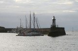
Small and shallow harbor, protected by a breakwater, in front of the village, used by fishing boats. The belfry of the church standing in the village of Port St. Gildas, at the NE end of the island, is prominent. La Vieille, a rock 14m high, lies 0.7 mile NNE of the harbor, ...
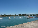
Port-Tudy: sympa, bien équipé (il y a un bassin à flot et un bassin de pleine eau équipés de pontons, plus un avant-port avec mouillages sur tonnes). Port St Nicolas: c'est tout petit, Locmaria (côte sud) : mouillages vaguement protégés par une jetée, port d'échouage ...


 Mouillage très fréquenté face à la grande plage de Treac'h er Goured, abritée des vents dominants de sud-ouest à nord-ouest.