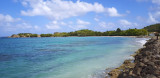
Closed by a coral reef which protects it from the waves of the open sea, the Baie du François is a vast shallow aquarium, rarely more than 10 meters, interspersed with white bottoms (strips of sand on which you walk) and small islands. The islets Oscar, Thierry, Long, Frégate, Métrente, ...
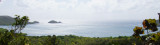
This small bay is very protected from prevailing winds and swells, which makes it a very safe anchorage. It is dominated by Château Dubuc, a tourist hotspot highlighted by a small museum. The entrance to the bay opens to the south and the eastern part of Galion Bay. Its body of water ...


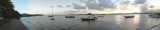
 Sur la plage à l'Est on y trouve les barques de pêcheurs et derrière le marché au poisson.
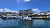
 Petit ponton pour bateaux à faible tirant d'eau.