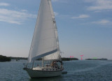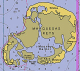

Marquesas Keys (Florida)
17nm
274°
8 Apr 12
Cham
| Latitude | Longitude | |
| DMS | --- | --- |
| DM | --- | --- |
| DD | --- | --- |


")
")
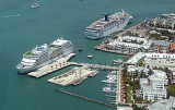
 The Fort Zachary Taylor is one of the most important fortresses of its time.
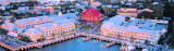
 Les navire à fort TE peuvent mouiller au SW de Fort Taylor, au SSE à environ 1 M de l'E de Triangle Light.
 Le mouillage est quelquefois exposé et les profondeurs sont de 7 à 11 m, par un fond de bonne tenue.
Ebook | Gulf of Mexico
|