Rijecki Zaljev

Rijecki Zaljev

To precisely geolocate this site. Update if necessary.

Localisation

Rijecki Zaljev
LatitudeLongitude
DMS------
DM------
DD------

Characteristics

Sea

Description

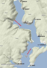
Rijecki Zaliv is an extensive basin in which several ports lie. It may be approached through three main channels and entered via three straits.

Kvarner, the W and widest channel, leads from the open Adriatic Sea end enters the basin via Kanal Vela Vrata.
Kvarneric, the middle channel, leads through Srednja Vrata into the basin. This channel is connected at its S end to the N end of Zadarski Kanal and to the open sea by Kvarnericka Vrata.

Velebitski Kanal, the E channel, is long and narrow and lies close W of the mainland. It is separated from Kvarneric to the W by several large islands. This channel leads through Vinodolski Kanal and Tihi Kanal at its N end and enters the NE head of the basin.
There are numerous anchorages for small craft along both shores of the N part of this channel. However, as there is little shelter for large vessels, this part of the channel is generally avoided during the late autumn and winter. At such times, large vessels proceed to Rijecki Zaliv via Srednja Vrata or Kvarner.

2011/07/31
Update
Jojo
Rijecki Zaliv est un vaste bassin dans lequel se trouvent plusieurs ports. Il peut être abordé à travers trois canaux principaux et est rejoint par trois détroits.
Kvarner, le canal à l'W, le plus large, part de l'extrémité de la mer Adriatique, au large, à travers le bassin intermédiaire Kanal Vela Vrata.
Kvarneric, le canal du milieu, mène à travers Srednja Vrata dans le bassin. Ce canal est relié à son extrémité S à l'extrémité N du Zadarski Kanal et au large par Kvarnericka Vrata.
Velebitski Kanal, le canal E, est long et étroit et longe le côté W de la partie continentale. Il est séparé de Kvarneric à l'W par plusieurs grandes îles. Ce canal conduit à  Vinodolski Kanal et Tihi Kanal à son extrémité N et pénètre dans la tête NE du bassin.
Il y a de nombreux mouillages pour les petites embarcations le long des deux rives de la partie N de ce canal. Cependant, comme il y a peu d'abris pour les grands navires, cette partie du canal est généralement évitée pendant la fin de l'automne et l'hiver. Pendant cette période, les grands navires vont à Rijecki Zaliv via Srednja Vrata ou Kvarner.
2011/07/31
Update
Jojo
Ebook

Kvarner

  • 120 sites
  • 182 photos
  • publication date: 7 Jul 2023
  • .pdf file size: 69 Mb
Share your comments or photos on "Rijecki Zaljev"

Sites around Rijecki Zaljev

Flying distances - Direct line

Kanal Vela Vrata

8.3nm
225°
Kanal Vela Vrata connects the N end of Kvarner to Rijecki Zaliv and leads between the N end of Otok Cres, on the E side, and the mainland coast, on the W side.
The channel is deep and clear, the bottom being formed of mud.
31 Jul 11
Jojo

Tihi kanal

7.9nm
87°
Tihi Kanal, 3 miles long, connects the NW end of Vinodolski Kanal to Rijecki Zaliv.
The channel is deep and tortuous and leads between the mainland and the NE end of Otok Krk.
2 Aug 11
Jojo

Otok Plavnik Kvarner

17nm
161°
Otok Plavnik lies with Rt Veli Pin, its N extremity, located 0.7 mile E of the E side of Otok Cres and divides Srednja Vrata in its S part into two channels.
This cliffy island is 194m high and partly wooded.
Several small islets lie on a shoal bank which extends about 1.5 miles ...
4 Aug 11
Jojo

Zaljev Rasa

20nm
223°
The large natural inlet Zaljev Rasa offers the best protection of all sectors of the entire E coast of Istria, while the Bora blows strongly here. This bay is sinking into the earth near 6M, between Rt Ubac and Rt Mulac. The Rijeka Rasa flows into the bottom, creating a current that ...
5 Sep 11
Jojo

Bakarski Zaljev Rijeka

7.2nm
64°
Bakarski Zaljev is a bayalmost closed on the continent, and SE of Rijeca N O. Krk. It is entered 6 NM ESE of Rijeka and is accessible by a channel of 0.3 nm wide at its narrowest point.
It is equipped with facilities for cargo.
There is a shipyard in Kraljevica, an oil terminal ...
31 Jul 11
Jojo

Kanal Krusija

17nm
162°
Kanal Krusija leads to the W of Otok Plavnik.
This channel is frequented because of its steep-to shores and deep passage.
A strong current may occasionally be experienced in this channel, depending on local weather conditions, but this passage is recommended over the one leading ...
4 Aug 11
Jojo