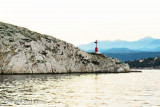
Tihi kanal
3nm
153°
The channel is deep and tortuous and leads between the mainland and the NE end of Otok Krk.
2 Aug 11
Jojo
| Latitude | Longitude | |
| DMS | --- | --- |
| DM | --- | --- |
| DD | --- | --- |

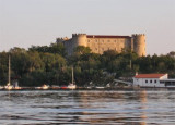
 Bakarski Zaljev is a bayalmost closed on the continent, and SE of Rijeca N O. Krk. It is entered 6 NM ESE of Rijeka and is accessible by a channel of 0.3 nm wide at its narrowest point.
 There is a shipyard in Kraljevica, an oil terminal and bulk handling equipment for cargo on each side near Bakar.
At the SE end, the small port of Bakarac offers a pleasant recreational boaters.
The entrance of Bakarski Zaljev is located between Rt Molnaric at NW and Rt Ostro at SE.
A shoal extends approximately 0.2 NM from the coast to the NW of Rt Ostro. Its NW end is signaled by a green buoy.
A 0.4 NM W of buoy and 0.25 nm SW of Rt Molnaric, an isolated rocky bank, within 10 m of water, can create rough seas in certain conditions.
Some remote areas beyond the coast of Bakarski Zaljev the approach of Bakar.
Winds—Weather.—The bora blows with great violence in the vicinity of Bakarski Zaliv and although the NW part of the basin is protected, the wind coming off the slopes in the S part sometimes renders the entrance impossible to navigation. The bora approaches suddenly, sometimes lasting for two or three days, and then ceases just as rapidly.
The scirocco blows along the axis of the basin and sometimes produces seas which frequently inundate the area.
 Bakarski Zaljev est une baie presque fermée sur le continent, au SE de Rijeca et au N d'O. Krk. Elle s'enfonce dans la terre sur 6 NM à l'ESE de Rijeka, et est accessible par un chenal de 0,3 NM de large en son point le plus étroit.
Elle est équipée d'installations pour les cargos.
Il y a un chantier naval à Kraljevica, un terminal pétrolier et des équipements de manutention en vrac pour les cargos sur chaque rive près de Bakar.
A l'extrémité SE, le petit port de Bakarac offre un cadre agréable aux plaisanciers.
L'entrée de Bakarski Zaljev se situe entre Rt Molnaric au NW et Rt Ostro au SE.
Un haut-fond s'étend sur près de 0,2 NM de la côte au NW de Rt Ostro. Son extrémité NW est signalée par une bouée verte.
A 0,4 NM à l'W de la bouée et à 0,25 NM au SW de Rt Molnaric, un banc rocheux isolé, sous 10 m d'eau, peut créer une mer dure dans certaines conditions.
Quelques zones isolées débordent la côte de Bakarski Zaljev à l'approche de Bakar.
Vents—La Bora souffle avec une grande violence dans le voisinage de Bakarski Zaliv et bien que la partie nord-ouest du bassin soit protégée, le vent venant des pentes dans la partie S rend parfois impossible l'entrée à la navigation. La Bora souffle soudainement, parfois durant deux ou trois jours, puis cesse tout aussi rapidement.
Les coups Scirocco souffle le long de l'axe du bassin et parfois produit une mer qui, souvent, inonde la zone.
Ebook | Kvarner
|
Ebook | Šibensko-kninska županija (Šibenik-Knin County)
|